Fortress
Fort Pikit
🇵🇭 Philippines · 19th century
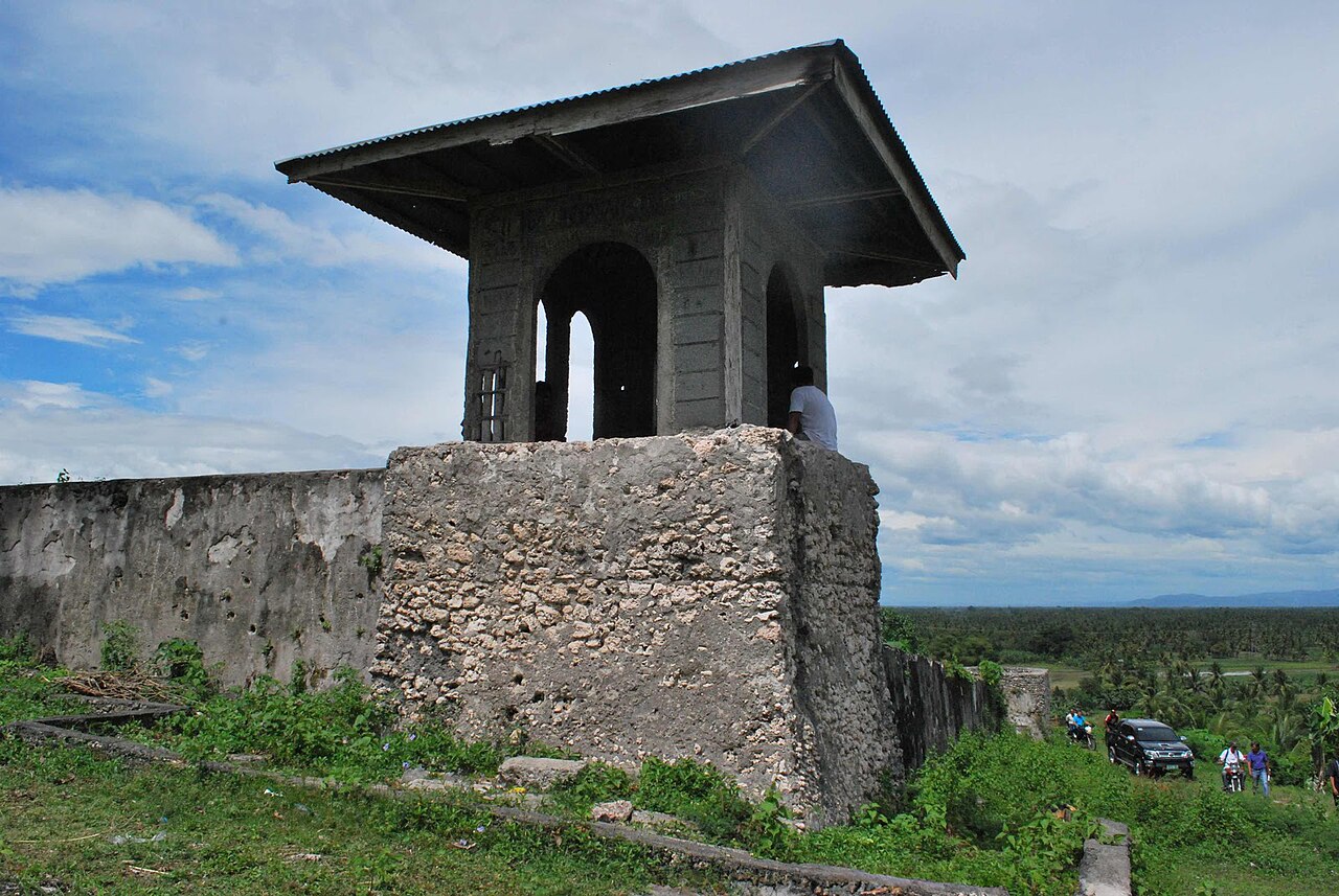
Fort Pikit is a Spanish colonial era stone fortification which was built in what is now known as the town of Malidegao in Cotabato. The fortification consists of two towers installed with artillery batteries and a rubble wall which measures 38 meters (125 ft) a side. It was intended to house a military officer, 60 infantrymen and 6 artillerymen by its Spanish builders.
It is situated at the back of the Municipal Hall of Pikit. on a hill facing the National Highway.
Text adapted from “Fort Pikit” on Wikipedia, CC BY-SA 4.0.
Fort Pikit ranks #7,459 of 8,134 worldwide in the atlas's castle fame ranking, and #10 of the 14 mapped in Philippines. Founded 1893 — one of 607 atlas entries founded in the 19th century. 1 more atlas landmarks stand within 25 km. See how Philippines compares in the castle statistics.
View on the interactive castle map →Frequently asked questions
Where is Fort Pikit?
Fort Pikit stands in the Philippines, at 7.06133°, 124.67807°.
When was Fort Pikit built?
The atlas dates its founding to 1893. Earlier structures may have stood on the site; this is the earliest documented founding year.
How famous is Fort Pikit?
In this atlas's fame ranking: #7,459 of 8,134 worldwide, and #10 in the Philippines. Fame here combines how many Wikipedia language editions cover a landmark with how many people read them.
What is the nearest castle to Fort Pikit?
Fuerte de Reina Regente, about 19 km away.
More castles in the Philippines
- Fort Culion Philippines · 18th century
- Malacañang Palace Philippines · 18th century
- Fort Santiago Philippines · 16th century
- Fort San Antonio Abad Philippines · 16th century
More fortresses
- Fort Amador Panama
- Mahakan Fort Thailand · 18th century
- Fort San Carlos, Campeche Mexico
- Jalore Fort India