 Netherlands · 19th century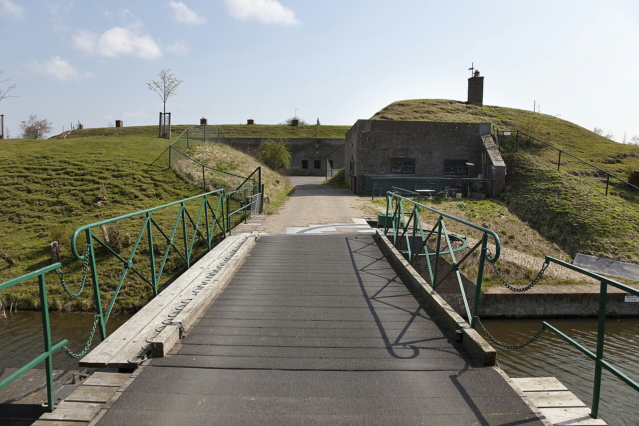
Fort Ronduit is a polygonal fort in Naarden built in the period 1873-1875 on the remains of an earlier defensive work. The fort served to cover the land outside the dykes to the north of the fortress of Naarden and as a redoubt, to which it owes its name.
The fort lies to the north of the fortress of Naarden and to the south of the former Zuiderzee. In the 17th century there was already a sconce on this spot to protect the harbour of Naarden, and in 1873-1875 the existing fort was built. Between the fort and the fortress lies a connecting rampart so that troops could move unseen by the enemy.
The fort has a guardhouse at the entrance and a centrally located bombproof barracks. The brick barracks contained rooms for the men, the quarters of the commander and the officers, and the kitchen. In the middle were magazines for the storage of ammunition. At the far left and right of the building are two rooms for housing the artillery. The building is covered with sand on the front side. In the front wall of the barracks and the sand covering there are two passages with doors so that the men could quickly reach the guns in the front rampart. The fort grounds are surrounded by a 25-35 metre wide wet moat and connected to the land by a crane bridge. Around the buildings lies a high earthen rampart with positions for the artillery.
In 1926 the fort, together with the fortress of Naarden, was decommissioned as a fortification. It was still used as an ammunition store. In 1986 the buildings were restored. The fort forms part of the New Dutch Waterline.
Machine-translated from “Fort Ronduit” on the Dutch Wikipedia, CC BY-SA 4.0.
Fort Ronduit ranks #8,352 of 9,079 worldwide in the atlas's castle fame ranking, and #170 of the 199 mapped in Netherlands. Founded 1875, it is older than 5% of the atlas's dated landmarks — one of 717 atlas entries founded in the 19th century. 19 more atlas landmarks stand within 25 km. The nearest day-trip guide is Amsterdam, 20 km away. See how Netherlands compares in the castle statistics.
View on the interactive castle map →