Fortress
Fortaleza de Santa Teresa
🇺🇾 Uruguay · 18th century
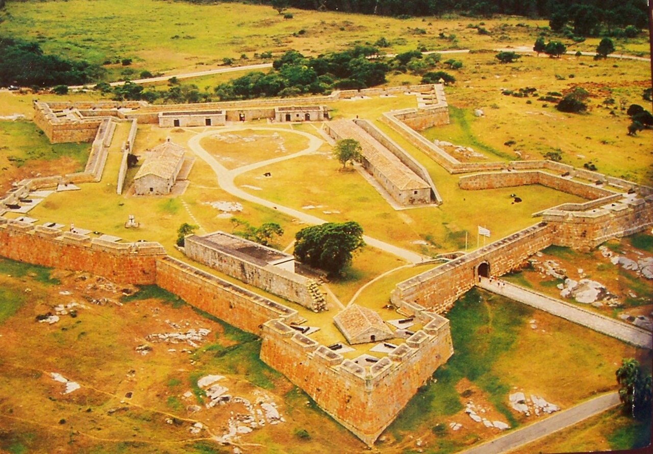
The Fortaleza de Santa Teresa, or Fortaleza Santa Tereza is a military fortification located 36 km (22 mi) south of Chuy and 305 km (190 mi) northeast of Montevideo on Route 9, in the Rocha Department of eastern Uruguay. It lies about 800 m (2,600 ft) from the coast at Playa la Moza, almost halfway between Angostura (to the south) and La Coronilla (to the north), north of Punta del Diablo and roughly 4 km (2.5 mi) northeast of the northeast bank of the Laguna Negra. It lies within the Santa Teresa National Park. It was erected from October 1762 by the Portuguese, having abandoned the attempt at building a fort in Maldonado and leaving the Fuerte San Miguel.
Text adapted from “Fortaleza de Santa Teresa” on Wikipedia, CC BY-SA 4.0.
Fortaleza de Santa Teresa ranks #4,038 of 8,134 worldwide in the atlas's castle fame ranking, and #2 of the 2 mapped in Uruguay. Founded 1762, it is older than 16% of the atlas's dated landmarks — one of 556 atlas entries founded in the 18th century. Its Wikipedia articles were opened 1,149 times in the last 60 days, more than 52% of the atlas. See how Uruguay compares in the castle statistics.
View on the interactive castle map →Frequently asked questions
Where is Fortaleza de Santa Teresa?
Fortaleza de Santa Teresa stands in Uruguay, at -33.97222°, -53.54861°.
When was Fortaleza de Santa Teresa built?
The atlas dates its founding to 1762. Earlier structures may have stood on the site; this is the earliest documented founding year.
How famous is Fortaleza de Santa Teresa?
In this atlas's fame ranking: #4,038 of 8,134 worldwide, and #2 in Uruguay. Fame here combines how many Wikipedia language editions cover a landmark with how many people read them.
What is the nearest castle to Fortaleza de Santa Teresa?
Cerro Fortress, about 269 km away.
More fortresses
- Verkhoturye Kremlin Russia · 17th century
- Fortress of Muxima Angola · 16th century
- Borj Nord Morocco · 16th century
- Fort Stevens United States · 19th century