Vesting
Fortaleza de Santa Teresa
🇺🇾 Uruguay · 18e eeuw
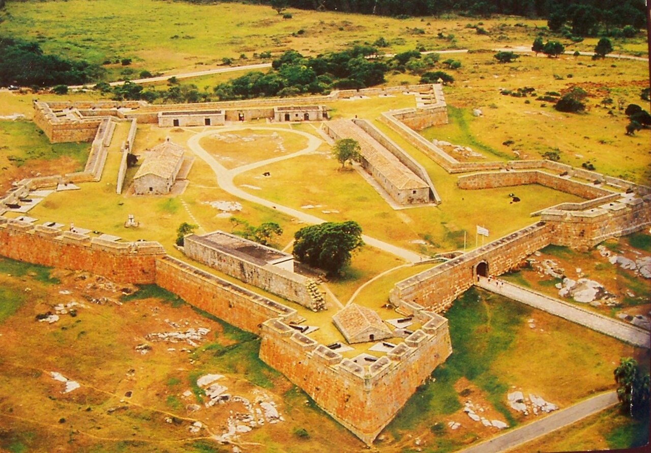
Fortaleza de Santa Teresa, of Fortaleza Santa Tereza, is een militaire vesting gelegen 36 km ten zuiden van Chuy en 305 km ten noordoosten van Montevideo, aan Route 9, in het departement Rocha in het oosten van Uruguay. Het ligt ongeveer 800 m van de kust bij Playa la Moza, bijna halverwege tussen Angostura (in het zuiden) en La Coronilla (in het noorden), ten noorden van Punta del Diablo en ongeveer 4 km ten noordoosten van de noordoostelijke oever van de Laguna Negra. Het ligt binnen het Nationaal Park Santa Teresa. Het werd vanaf oktober 1762 opgetrokken door de Portugezen, nadat zij de poging om een fort in Maldonado te bouwen hadden opgegeven en Fuerte San Miguel hadden verlaten.
Machinaal vertaald uit “Fortaleza de Santa Teresa” op de Engelstalige Wikipedia, CC BY-SA 4.0.
Fortaleza de Santa Teresa staat op plaats 4.038 van 8.134 in de bekendheidsranglijst van deze atlas en op plaats 2 van de 2 die de atlas in Uruguay in kaart brengt. Gebouwd in 1762, en daarmee ouder dan 16% van de gedateerde bouwwerken in de atlas — een van de 556 bouwwerken in de atlas die uit de 18e eeuw stammen. De Wikipedia-artikelen erover werden de afgelopen 60 dagen 1.149 keer geopend, meer dan 52% van de atlas. Zie hoe dat zich verhoudt in de kastelenstatistiek.
Bekijk op de interactieve kastelenkaart →Veelgestelde vragen
Waar ligt Fortaleza de Santa Teresa?
Fortaleza de Santa Teresa ligt in Uruguay, op -33.97222°, -53.54861°.
Wanneer werd Fortaleza de Santa Teresa gebouwd?
De atlas dateert de stichting op 1762. Er kunnen eerdere bouwwerken hebben gestaan; dit is het oudste gedocumenteerde bouwjaar.
Hoe bekend is Fortaleza de Santa Teresa?
In de bekendheidsranglijst van deze atlas: plaats 4.038 van 8.134 wereldwijd, plaats 2 in Uruguay. Bekendheid combineert het aantal Wikipedia-taalversies met het aantal lezers.
Welk kasteel ligt het dichtst bij Fortaleza de Santa Teresa?
Cerro Fortress, ongeveer 269 km verderop.
Meer vestingen
- Verkhoturye Kremlin Rusland · 17e eeuw
- Fortress of Muxima Angola · 16e eeuw
- Borj Nord Marokko · 16e eeuw
- Fort Stevens Verenigde Staten · 19e eeuw