Fortress
Forte de São Lourenço
🇧🇷 Brazil · 17th century
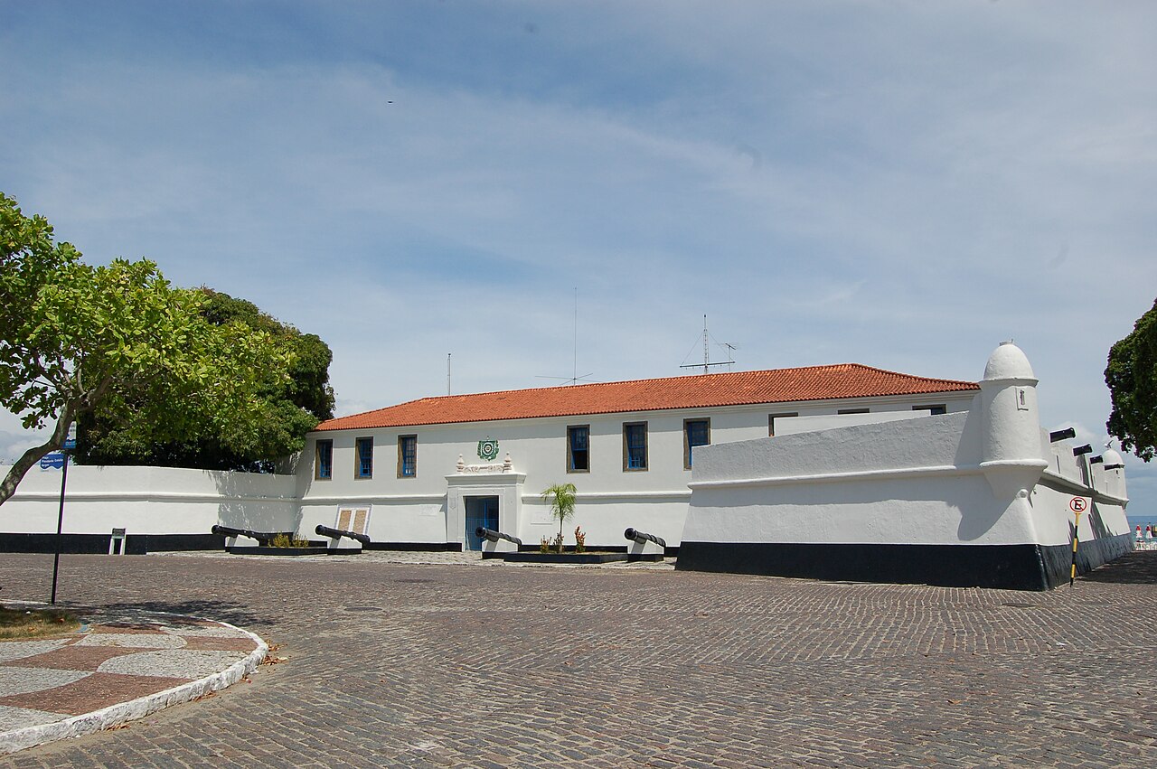
Forte de São Lourenço (English language: Fort of Saint Lawrence) is a fort located in Itaparica, Bahia in Brazil. It sits on a strategic point at the north of Itaparica Island on a site used for whaling in the early 17th century. The Dutch constructed a small earthwork fortification on the site during the Dutch occupation of Brazil (1630–1654); it was reconstructed by the Portuguese in its present form in the early 18th century. The fort was used by Brazilian forces during the Brazilian struggle for independence in 1823; the Brazilian Navy has owned the fort since the same year. The Forte de São Lourenço was listed as a federal historic structure in 1938.
Text adapted from “Forte de São Lourenço” on Wikipedia, CC BY-SA 4.0.
Forte de São Lourenço ranks #7,217 of 8,134 worldwide in the atlas's castle fame ranking, and #42 of the 80 mapped in Brazil. Founded 1647, it is older than 28% of the atlas's dated landmarks — one of 626 atlas entries founded in the 17th century. 12 more atlas landmarks stand within 25 km. See how Brazil compares in the castle statistics.
View on the interactive castle map →Frequently asked questions
Where is Forte de São Lourenço?
Forte de São Lourenço stands in Brazil, at -12.87944°, -38.68545°.
When was Forte de São Lourenço built?
The atlas dates its founding to 1647. Earlier structures may have stood on the site; this is the earliest documented founding year.
How famous is Forte de São Lourenço?
In this atlas's fame ranking: #7,217 of 8,134 worldwide, and #42 in Brazil. Fame here combines how many Wikipedia language editions cover a landmark with how many people read them.
What is the nearest castle to Forte de São Lourenço?
Fort of Monserrate, about 19 km away.
More castles in Brazil
- Forte de São Diogo Brazil
- Forte de Santo Inácio de Tamandaré Brazil
- Forte de São João da Bertioga Brazil · 16th century
- Forte de São Mateus do Cabo Frio Brazil
More fortresses
- Ellewoutsdijk Fort Netherlands
- Fort Vijf Sinnen India
- Fort Geldria India · 17th century
- Fort bij Hinderdam Netherlands