 Kosovo · 6th century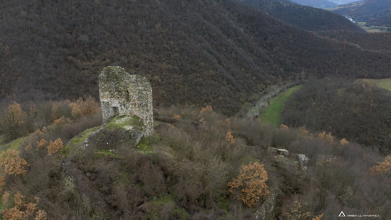
Pogragja Fortress is a fortress located near village of Pogragjë, 10 kilometers south-east of Gjilan, Kosovo. It was built on a hill overlooking the confluence of a stream in Morava e Binçës and dates back to 6th century.
The fortress is situated on a hill that rises about 50 meters above the river valley. It consists of the Lower Town, surrounded by walls and a more preserved citadel (Upper Town) at the top of the hill.
The layout of Upper Town is based on irregular pentagon that follows the shape of the hilltop, with three vertices (southwest, northwest and northeast) reinforced with towers. At the highest point of fortress is a donjon tower, roughly square in plan (about 8x8m) of which are preserved west wall up to a height of about 10 meters with an entrance and part of the south wall with arrowslits, while the remains of the east wall are visible the remains of another arrowslit. The entrance to the Upper Town was located probably northwest of the tower, on the side from which the fort was the easiest to approach, since it shows the remains of the access ramp. Remnants of other buildings were found in the area. Fortress walls are in some places, preserved up to 4 meters in height.
The Pogragja Fortress is located 10 km southeast of Gjilan, respectively 1 km from village Pogragjë. It is positioned in the Karadak Mountains, at 567 meters above sea level, on the foothills of which Morava e Binçes river flows. The castle has an interior area of 1.2 hectares and is typical for the Justinian era (6th century), respectively part of the network of fortresses raised in Dardania by the end of late antiquity. This is also proven by written documents and coins found during the castle conservation and exploration activities. The oldest coin found in the castle dates back to 246–249 and holds the portrait of Otacila Severa, the first wife of Philip.
The layout of Pogragja castle's citadel has the shape of an irregular pentagon, whereas the southern wall of the central tower plays the role of citadel's protective wall, which is one of the characteristics of this castle. Pogragja castle possesses three protective walls, qualified as the first, second and third protective wall. One part of these walls is located above ground, whereas the rest is located underground.
Text adapted from “Pogragja Fortress” on Wikipedia, CC BY-SA 4.0.
Gradište ranks #7,508 of 9,079 worldwide in the atlas's castle fame ranking, and #9 of the 11 mapped in Kosovo. Founded c. 550, it is older than 96% of the atlas's dated landmarks — one of 39 atlas entries founded in the 6th century. 3 more atlas landmarks stand within 25 km. The nearest day-trip guide is Skopje, 49 km away. See how Kosovo compares in the castle statistics.
View on the interactive castle map →