Ruin
Guttenberg Castle
🇩🇪 Germany · 12th century
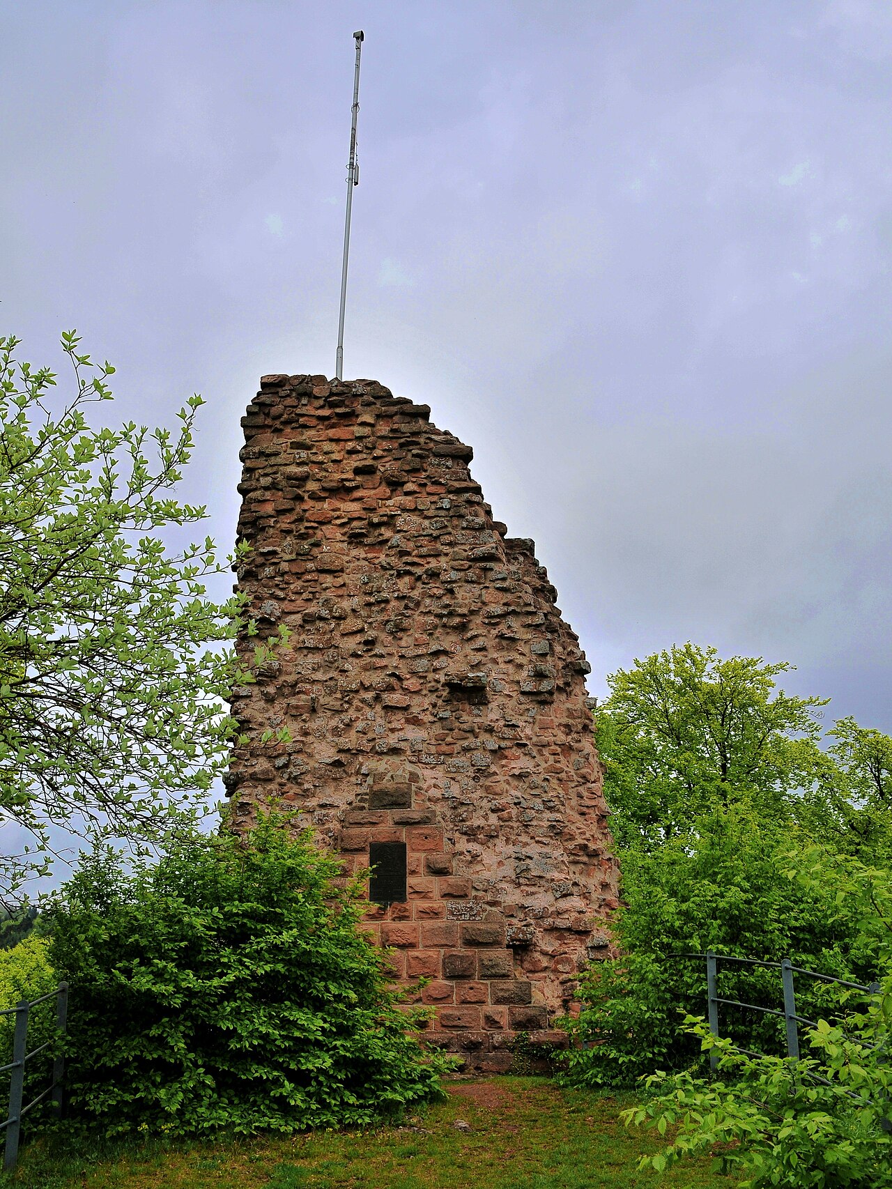
Guttenberg Castle (German: Burg Guttenberg, more rarely, Guttenburg) is a ruined rock castle near the French border in the German part of the Wasgau, which in turn is part of the Palatine Forest in the state of Rhineland-Palatinate.
The hill castle is located in the Upper Mundat Forest about three kilometres west of the village of Oberotterbach on the 503-metre-high Schlossberg hill. One kilometre away are the Hohe Derst (561 m) to the northwest and Hohe Kopf (497 m) to the south. The Otterbach, a left tributary of the River Rhine, rises on the northeastern slopes of the Schlossberg, below the castle.
The castle was possibly first mentioned in 1151 as an imperial castle of the Hohenstaufen emperors which was managed by the ministerialis, Landolfo de Gudenburc, or it may have been connected with Ulrich of Guttenberg (Udelricus de Gudenburhc) who gifted it in 1174 to Eusserthal Abbey. The first confirmed record occurs in 1246 when Isengard of Falkenstein, on behalf of her husband, the imperial steward (Reichstruchsess), Philip I of Falkenstein, transferred the castle to King Conrad IV.
In 1317, half of the castle was enfeoffed to the counts of Leiningen, whilst the other half went, a little later, to Electoral Palatinate.
In the division of the Palatinate of 1410 the castle was allocated to Stephen, Count Palatine of Simmern-Zweibrücken. The Leiningens lost their share in 1463 when it went via the Hanau-Lichtenbergs to the House of Palatinate-Zweibrücken branch of the Wittelsbach dynasty.
In 1525, during the German Peasants' War Guttenberg Castle was destroyed by a Lorraine peasant mob. The ruins were never rebuilt and its associated office or Amt moved to Dörrenbach. With the extinction of the Heidelberg line in 1559, Palatine Zweibrücken also inherited the other half of the Barony of Guttenberg including the related part of the ruined castle.
From 1680 to 1697 the region was under French hegemony as part of the successes achieved under France's policy of reunion. From 1792 to 1815 the region was part of the First French Republic and was assigned to the département du Bas-Rhin (Department of Lower Rhine). In November 1815 the area between the rivers Lauter and Queich, including the ruins of Guttenberg, came under the sovereignty of the Empire of Austria as a result of the agreements reached in the Second Treaty of Paris.
Text adapted from “Guttenberg Castle (Palatinate)” on Wikipedia, CC BY-SA 4.0.
Guttenberg Castle ranks #5,332 of 8,134 worldwide in the atlas's castle fame ranking, and #406 of the 505 mapped in Germany. Founded c. 1151, it is older than 81% of the atlas's dated landmarks — one of 564 atlas entries founded in the 12th century. 27 more atlas landmarks stand within 25 km. The nearest day-trip guide is Karlsruhe, 36 km away. See how Germany compares in the castle statistics.
View on the interactive castle map →Frequently asked questions
Where is Guttenberg Castle?
Guttenberg Castle stands in Germany, at 49.0777°, 7.92136°.
When was Guttenberg Castle built?
The atlas dates its founding to c. 1151. Earlier structures may have stood on the site; this is the earliest documented founding year.
How famous is Guttenberg Castle?
In this atlas's fame ranking: #5,332 of 8,134 worldwide, and #406 in Germany. Fame here combines how many Wikipedia language editions cover a landmark with how many people read them.
What is the nearest castle to Guttenberg Castle?
Berwartstein Castle, about 5 km away.
More castles in Germany
- Burg Guttenberg Germany
- Langenstein Castle Germany · 11th century
- Schloss Liebenstein Germany
- Arenfels Castle Germany · 13th century
More ruins
- Falkenburg Castle Germany · 11th century
- Castle Grafendahn Germany · 13th century
- Kitsuki Castle Japan · 14th century
- Castle Tanstein Germany · 11th century