Ruin
Hohengeroldseck
🇩🇪 Germany · 13th century
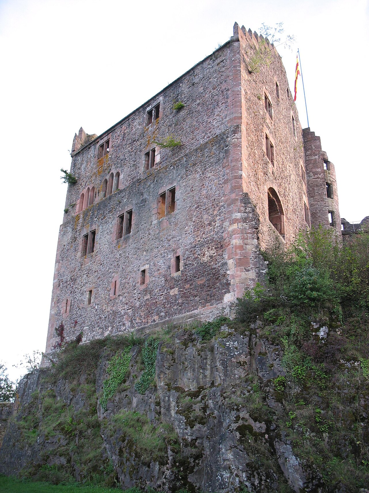
Hohengeroldseck is the ruin of a hilltop castle at 523.9 m above sea level in the Black Forest. It lies on a rise between the Kinzig valley and the Schutter valley in the Schönberg district of the municipality of Seelbach in the Ortenaukreis in Baden-Württemberg. The castle was the ancestral seat of the lords of Geroldseck. On a spur hilltop 1,700 metres to the north lies the ruin of Alt-Geroldseck castle.
Machine-translated from “Burg Hohengeroldseck” on the German Wikipedia, CC BY-SA 4.0.
Hohengeroldseck ranks #4,783 of 8,134 worldwide in the atlas's castle fame ranking, and #364 of the 505 mapped in Germany. Founded c. 1250, it is older than 69% of the atlas's dated landmarks — one of 861 atlas entries founded in the 13th century. 4 more atlas landmarks stand within 25 km. The nearest day-trip guide is Strasbourg, 32 km away. See how Germany compares in the castle statistics.
View on the interactive castle map →Frequently asked questions
Where is Hohengeroldseck?
Hohengeroldseck stands in Germany, at 48.3325°, 7.98028°.
When was Hohengeroldseck built?
The atlas dates its founding to c. 1250. Earlier structures may have stood on the site; this is the earliest documented founding year.
How famous is Hohengeroldseck?
In this atlas's fame ranking: #4,783 of 8,134 worldwide, and #364 in Germany. Fame here combines how many Wikipedia language editions cover a landmark with how many people read them.
What is the nearest castle to Hohengeroldseck?
Alt-Geroldseck Castle, about 2 km away.
More castles in Germany
- Zwingenberg Castle Germany · 14th century
- Heldburg Fortress Germany · 16th century
- Windeck Castle Germany · 12th century
- Lichtenberg Castle (Palatinate) Germany · 12th century
More ruins
- Riberhus Denmark
- Château du Hohlandsbourg France · 13th century
- Château de l'Ortenbourg France · 13th century
- Château de Vendôme France · 10th century