Castle
Kasteel Renswoude
🇳🇱 Netherlands · 14th century
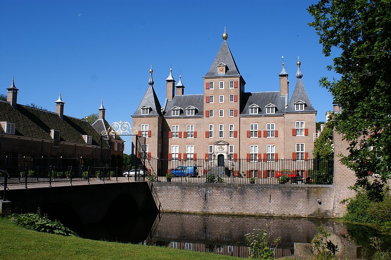
Kasteel Renswoude (in Dutch: Kasteel Renswoude) is a historic building in the Dutch town of Renswoude in the province of Utrecht, built in the 1650s on the ruins of a fortress of the second half of the 14th century and altered in the course of the 19th century. The castle was the residence of the lords Taets van Amerongen.
Machine-translated from “Castello di Renswoude” on the Italian Wikipedia, CC BY-SA 4.0.
Kasteel Renswoude ranks #6,768 of 8,134 worldwide in the atlas's castle fame ranking, and #122 of the 201 mapped in Netherlands. Founded c. 1350, it is older than 57% of the atlas's dated landmarks — one of 604 atlas entries founded in the 14th century. 10 more atlas landmarks stand within 25 km. The nearest day-trip guide is Arnhem, 27 km away. See how Netherlands compares in the castle statistics.
View on the interactive castle map →Frequently asked questions
Where is Kasteel Renswoude?
Kasteel Renswoude stands in the Netherlands, at 52.07064°, 5.5446°.
When was Kasteel Renswoude built?
The atlas dates its founding to c. 1350. Earlier structures may have stood on the site; this is the earliest documented founding year.
How famous is Kasteel Renswoude?
In this atlas's fame ranking: #6,768 of 8,134 worldwide, and #122 in the Netherlands. Fame here combines how many Wikipedia language editions cover a landmark with how many people read them.
What is the nearest castle to Kasteel Renswoude?
Landgoed Schaffelaar, about 9 km away.
More castles in the Netherlands
- Huis te Riviere Netherlands · 13th century
- Horn Castle Netherlands
- Huis Verwolde Netherlands
- Huis ter Kleef Netherlands · 14th century
More castles
- Marid Castle Saudi Arabia
- Estergon Castle (Ankara) Turkey
- Zaliztsi Castle Ukraine · 16th century
- Kryvche Castle Ukraine · 17th century