Ruin
Kasteel te Culemborg
🇳🇱 Netherlands
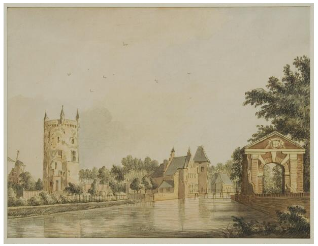
The Kasteel te Culemborg is the ruin of the former castle situated to the north of Culemborg, in the Dutch province of Gelderland. The site where the castle stood now serves as the town's public historical cultural park.
Machine-translated from “Château de Culemborg” on the French Wikipedia, CC BY-SA 4.0.
Kasteel te Culemborg ranks #7,251 of 8,134 worldwide in the atlas's castle fame ranking, and #159 of the 201 mapped in Netherlands. 28 more atlas landmarks stand within 25 km. The nearest day-trip guide is Utrecht, 16 km away. See how Netherlands compares in the castle statistics.
View on the interactive castle map →Frequently asked questions
Where is Kasteel te Culemborg?
Kasteel te Culemborg stands in the Netherlands, at 51.95989°, 5.22551°.
How famous is Kasteel te Culemborg?
In this atlas's fame ranking: #7,251 of 8,134 worldwide, and #159 in the Netherlands. Fame here combines how many Wikipedia language editions cover a landmark with how many people read them.
What is the nearest castle to Kasteel te Culemborg?
Duurstede Castle, about 8 km away.
More castles in the Netherlands
- Kasteel IJsselstein Netherlands
- Kasteel Endegeest Netherlands · 14th century
- Vaeshartelt Castle Netherlands · 18th century
- Zuylestein Castle Netherlands · 16th century
More ruins
- Achipse Fortress Russia
- Tsetsyno Fortress Ukraine · 14th century
- Staryi Zbarazh Castle Ukraine · 15th century
- Chervonohorod Castle Ukraine