Fortress
Madh Fort
🇮🇳 India · 17th century
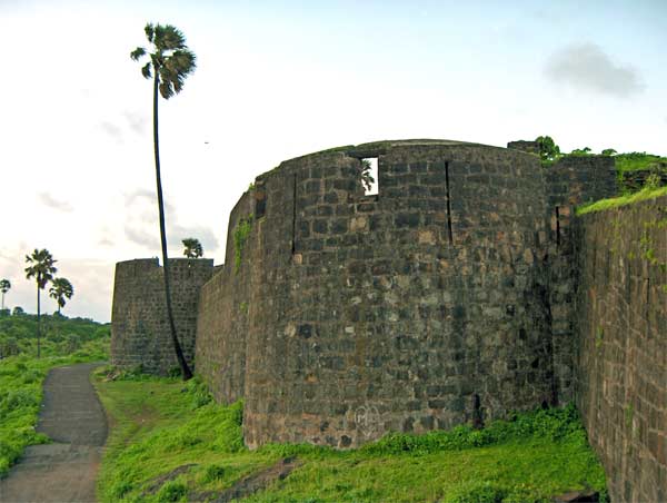
Madh (Marathi pronunciation: [məɖʱ]) is a peninsular locality in the northern part of the Mumbai Suburban District, Maharashtra, India. Historically, it was an island, but land reclamations in the 20th century connected it to Malad village on Salsette Island.
The former Madh Island is surrounded by the Manori-Gorai creek in the north, the Arabian Sea in the west and south, and the Versova creek in the east. The waters in the north have been reclaimed, connecting it to Malad. The area has four long sandy beaches: Marve, Aksa, Erangal and Madh. It has four major villages with same names - Marve, Aksa, Erangal, and Madh - besides smaller settlements (wadis) such as Shankar-wadi, Patel-wadi, and Pascal-wadi. A substantial part is under the control of the Indian Navy and the Indian Air Force facilities.
Administratively, Madh is a village in the Andheri taluka of the Mumbai Suburban district.
The area is accessible by bus service (#271 to Malad and #269 to Borivali) or an autorickshaw from Malad. There is also a ferry service from Versova.
Madh Fort is a small fort in northern Mumbai, India situated at Madh Island. It was built by the Portuguese in Portuguese occupied India. They lost it during the war against Maratha Empire when the Maratha Empire captured it in February 1739.
The British occupied Salsette Island, Thana Fort, Fort Versova, and the island fort of Karanja in 1774.
Text adapted from “Madh Island” on Wikipedia, CC BY-SA 4.0.
Madh Fort ranks #2,677 of 8,134 worldwide in the atlas's castle fame ranking, and #101 of the 179 mapped in India. Founded c. 1650, it is older than 26% of the atlas's dated landmarks — one of 626 atlas entries founded in the 17th century. Its Wikipedia articles were opened 4,616 times in the last 60 days, more than 84% of the atlas. 8 more atlas landmarks stand within 25 km. The nearest day-trip guide is Mumbai, 11 km away. See how India compares in the castle statistics.
View on the interactive castle map →Frequently asked questions
Where is Madh Fort?
Madh Fort stands in India, at 19.13228°, 72.79479°.
When was Madh Fort built?
The atlas dates its founding to c. 1650. Earlier structures may have stood on the site; this is the earliest documented founding year.
How famous is Madh Fort?
In this atlas's fame ranking: #2,677 of 8,134 worldwide, and #101 in India. Fame here combines how many Wikipedia language editions cover a landmark with how many people read them.
What is the nearest castle to Madh Fort?
Castella de Aguada, about 10 km away.
More castles in India
- Kondaveedu Fort India
- Buxa Fort India · 19th century
- Fort Tiracol India
- Fortaleza da São Tomé India · 16th century
More fortresses
- Shiryōkaku Japan · 19th century
- Ustra Fortress Bulgaria · 10th century
- Kalâa of Ait Abbas Algeria · 16th century
- Fort Saint-André (Villeneuve-lès-Avignon) France · 14th century