 Ireland · 18th century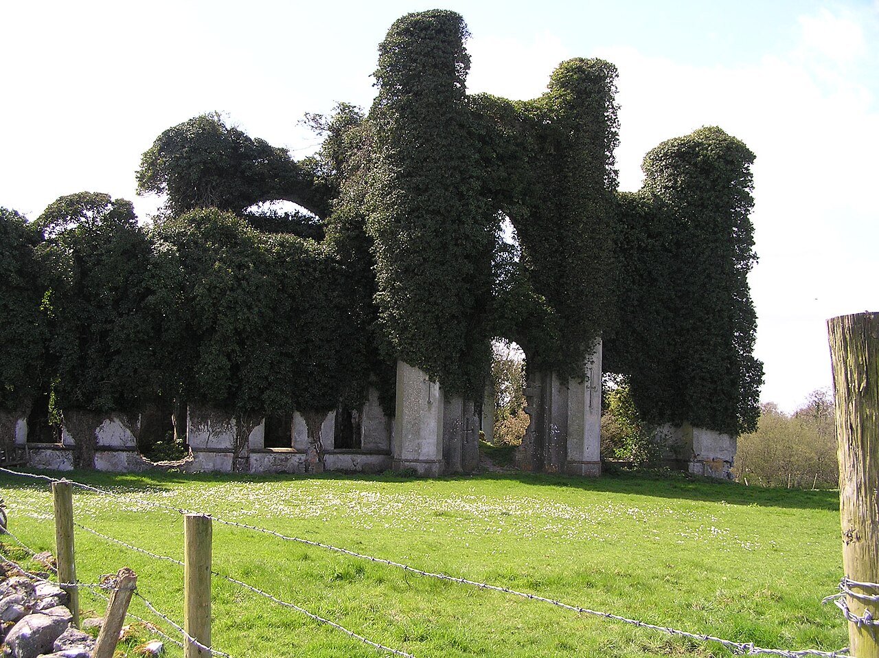
Moydrum Castle (Irish: Caisleán Maigh Droma meaning "plain of the ridge") is a ruined castle situated in the townland of Moydrum in County Westmeath in Ireland, just to the east of Athlone. The property is privately owned.
The lands of Moydrum were granted by the English Crown to the Handcock family, originally from Devon in England, during the Cromwellian plantations of Ireland in the 17th century. From then on the family remained one of the most prominent landowning dynasties and landlords in the area. Moving forward several generations, head of family William Handcock served as a Member of Parliament (MP) in Grattan's Parliament, representing Athlone until the parliament’s dissolution following the Acts of Union 1800 with the United Kingdom. Handcock had originally been an opponent of the Act, but was promised a peerage should he vote in favour of it.
He duly succumbed and finally, in 1812, Handcock was created 1st Baron Castlemaine. The Baron decided to create an appropriate stately home on his lands at Moydrum, and therefore asked architect Richard Morrison to remodel and enlarge an existing house belonging to the family there, built c.1750. The resulting gothic-revivalist castle was completed in 1814 and was described in A Topographical Dictionary of Ireland, published in 1837 by Samuel Lewis, as "a handsome castellated mansion [..] beautifully situated in an extensive demesne, on one side of which is a small lake".
By the 1880s, and the time of the 4th Baron, the Barony of Moydrum comprised 11,444 acres (46.3 km2).
The Lords Castlemaine were prominent members of Lough Ree Yacht Club, and Major G.S. Handcock was Hon. Secretary of the club. In 1920, he was appointed chairman of a committee to agree on the design of an 18-foot one design dinghy for the Shannon Yacht Clubs which became known as the Shannon-One-Design.
During the Irish War of Independence, Major-general Thomas Stanton Lambert was killed by a flying column of the Irish Republican Army (IRA) near Moydrum on 20 June 1921, in a failed attempt to take him prisoner for a planned prisoner exchange with general Seán Mac Eoin. In reprisal, the Black and Tans burned several farmsteads in south Westmeath. Angered by the burnings, local IRA members decided to burn Moydrum Castle in retaliation.
Text adapted from “Moydrum Castle” on Wikipedia, CC BY-SA 4.0.
Moydrum Castle ranks #3,032 of 9,035 worldwide in the atlas's castle fame ranking, and #42 of the 178 mapped in Ireland. Founded c. 1750, it is older than 16% of the atlas's dated landmarks, one of 685 atlas entries founded in the 18th century. Its Wikipedia articles were opened 1,820 times in the last 60 days, more than 67% of the atlas. 1 more atlas landmarks stand within 25 km. The nearest day-trip guide is Galway, 81 km away. See how Ireland compares in the castle statistics.
View on the interactive castle map →