 Ireland · 16th century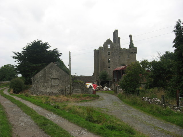
Ballycowan Castle is a castle located 4 km west of Tullamore, County Offaly. It was built in 1589 as a fortified house by Thomas Morres.
The castle was built on the previous site of the O’Molloy castle or tower house called Baile-mhic-Abhainn which was destroyed by a fire in 1557.
The adjacent tower was built by Sir Jasper Herbert and his wife Lady Jane Finglas in 1626 on land given to them during plantations.
During the Cromwellian period the southern end of the castle was blown up from a hill 100 yards away. The lands on which the castle stood were confiscated and handed over to the Earl of Mountrath in 1666.
Text adapted from “Ballycowan Castle” on Wikipedia, CC BY-SA 4.0.
Ballycowan Castle ranks #8,450 of 9,079 worldwide in the atlas's castle fame ranking, and #178 of the 178 mapped in Ireland. Founded 1589, it is older than 33% of the atlas's dated landmarks — one of 891 atlas entries founded in the 16th century. 3 more atlas landmarks stand within 25 km. The nearest day-trip guide is Dublin, 87 km away. See how Ireland compares in the castle statistics.
View on the interactive castle map →