 Northern Ireland · 17th century
Moyry Castle ranks #5,323 of 9,040 worldwide in the atlas's castle fame ranking, and #21 of the 39 mapped in Northern Ireland. Founded 1601, it is older than 30% of the atlas's dated landmarks, one of 710 atlas entries founded in the 17th century. 5 more atlas landmarks stand within 25 km. The nearest day-trip guide is Drogheda, 40 km away. See how Northern Ireland compares in the castle statistics.
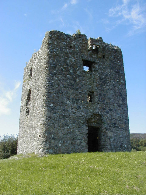
Moyry Castle (from the Irish Maġ Rí or "plain of the king") is a small 17th century castle in County Armagh, Northern Ireland. It was built during the latter stages of the Nine Years' War in June 1601 by Lord Mountjoy to help secure Moyry Pass and the Gap of the North. It is set in the corner of a small bawn and is a rectangular tower three storeys high.
Moyry Castle is a State Care Historic Monument sited in the townland of Carrickbroad, in Newry, Mourne and Down District Council area, at grid ref: J0576 1466. The castle is 7.5 miles (12 km) south of Newry town centre, and 5 miles (8 km) north of Dundalk town centre.
Moyry Castle, is built on solid rock, It is almost square, 8 metres (26 ft) each way and is three stories high. There are musketry loopholes on each wall except the North facing wall. This wall held the fireplaces which protrude on the outside.
Text adapted from “Moyry Castle” on Wikipedia, CC BY-SA 4.0.
View on the interactive castle map →