Castle
Narrow Water Castle
NIR Northern Ireland · 16th century
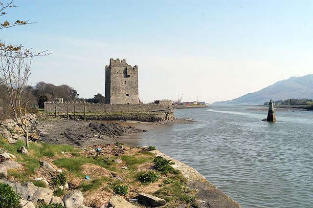
Narrow Water Castle (Irish: Caisleán an Chaoil; Ulster-Scots: Narra Wattèr Castle) is a 16th-century tower house and bawn near Warrenpoint in Northern Ireland. It is beside the A2 road and on the County Down bank of the Clanrye (Newry) River, which enters Carlingford Lough 1-mile (1.6 km) to the south. It is a historic monument in state care in the townland of Narrow Water, in Newry and Mourne District Council district, at grid ref: J1256 1939.
Text adapted from “Narrow Water Castle” on Wikipedia, CC BY-SA 4.0.
Narrow Water Castle ranks #3,254 of 8,134 worldwide in the atlas's castle fame ranking, and #14 of the 36 mapped in Northern Ireland. Founded c. 1550, it is older than 39% of the atlas's dated landmarks — one of 755 atlas entries founded in the 16th century. Its Wikipedia articles were opened 1,565 times in the last 60 days, more than 61% of the atlas. 4 more atlas landmarks stand within 25 km. The nearest day-trip guide is Drogheda, 45 km away. See how Northern Ireland compares in the castle statistics.
View on the interactive castle map →Frequently asked questions
Where is Narrow Water Castle?
Narrow Water Castle stands in Northern Ireland, at 54.1148°, -6.2828°.
When was Narrow Water Castle built?
The atlas dates its founding to c. 1550. Earlier structures may have stood on the site; this is the earliest documented founding year.
How famous is Narrow Water Castle?
In this atlas's fame ranking: #3,254 of 8,134 worldwide, and #14 in Northern Ireland. Fame here combines how many Wikipedia language editions cover a landmark with how many people read them.
What is the nearest castle to Narrow Water Castle?
Moyry Castle, about 8 km away.
More castles in Northern Ireland
- Crom Castle Northern Ireland · 19th century
- Dunseverick Castle Northern Ireland
- Glenarm Castle Northern Ireland · 17th century
- Ballygally Castle Northern Ireland · 17th century
More castles
- Northampton Castle England · 11th century
- Bowes Castle England
- Builth Castle Wales · 13th century
- Caister Castle England · 15th century