Fortress
Totleben
🇷🇺 Russia · 19th century
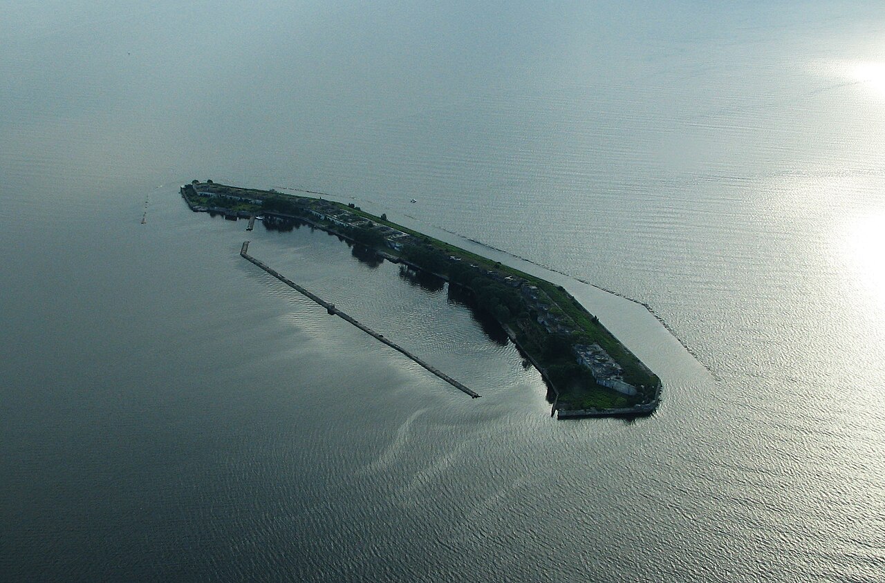
Totleben (Russian Тотлебен) is a Russian artificial island about one kilometre long in the shape of a recumbent "C" with an area of 4.8 ha, and a former fort in the Baltic Sea off Saint Petersburg; the fortification consists of three front sections and two short flanking sections. A continuous road between the command posts, casemates and the harbour connects the quarters for about 700 people.
Machine-translated from “Totleben (Insel)” on the German Wikipedia, CC BY-SA 4.0.
Totleben ranks #5,789 of 8,134 worldwide in the atlas's castle fame ranking, and #114 of the 145 mapped in Russia. Founded 1896 — one of 607 atlas entries founded in the 19th century. Its Wikipedia articles were opened 1,202 times in the last 60 days, more than 53% of the atlas. 5 more atlas landmarks stand within 25 km. The nearest day-trip guide is Saint Petersburg, 30 km away. See how Russia compares in the castle statistics.
View on the interactive castle map →Frequently asked questions
Where is Totleben?
Totleben stands in Russia, at 60.08528°, 29.84861°.
When was Totleben built?
The atlas dates its founding to 1896. Earlier structures may have stood on the site; this is the earliest documented founding year.
Is Totleben a UNESCO World Heritage Site?
Yes — it is part of a UNESCO World Heritage Site, per its Wikidata entry.
How famous is Totleben?
In this atlas's fame ranking: #5,789 of 8,134 worldwide, and #114 in Russia. Fame here combines how many Wikipedia language editions cover a landmark with how many people read them.
What is the nearest castle to Totleben?
Kronstadt Fortress, about 11 km away.
More castles in Russia
- Kuznetsk Fortress Russia · 18th century
- Prince of Oldenburg Castle Russia · 20th century
- Belgorod Fortress Russia · 16th century
- Post #1 Russia · 20th century
More fortresses
- Forte Duque de Caxias Brazil
- Fortress of Santo Antônio de Ratones Brazil · 18th century
- Byzantine Fort in Timgad Algeria · 6th century
- Temzezdekt Algeria · 14th century