 Bulgaria · 12th century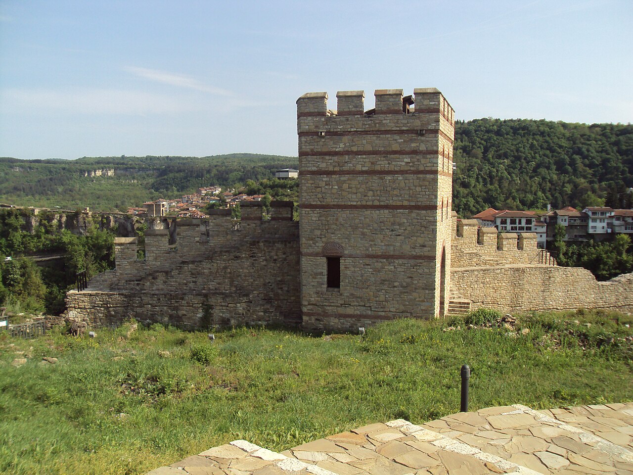
Trapezitsa (Bulgarian: Трапезица) is a medieval stronghold located on a hill with the same name in Veliko Tarnovo in northern Bulgaria.
Trapezitsa is located on a hill around which the Yantra River winds. It rises about 81 meters above the river level. Steep cliffs make the place difficult to access. The protected area is approximately 470x300 meters, with the elongated part facing north-south. The maximum area of the fortification is approximately 66.2 decares.
The name of Trapezitza is believed to derive from the word “трапеза” (table) or from “trapezium” as is the shape of the plateau. The most likely origin is the word “trapezits” – soldiers guarding the passes who were the first settlers on the hill in the Middle Ages.
The first fortified settlement, built on the hill, dates from the late Chalcolithic (4200-4000 BC).
During the Bronze Age (XIII-XII centuries BC) and the Early Iron Age (IX-VII centuries BC) there was a Thracian settlement on the hill.
The first traces of the medieval defense system on Trapezitsa date back to the 60-80s of the XII century. Main fortifications were built in the XIII and XIV centuries, during the Second Bulgarian Empire. Then Tarnovo became the capital of Bulgaria, and Trapezitsa was the second most important citadel of the city, after Tsarevets.
In 1195 Tsar Ivan Asen I transferred the relics of St. Ivan Rilski to a church built on Trapezitsa Hill. A monastery was built around it, bearing the name of the saint. Tsar Kaloyan transferred the relics of St. Gabriel of Lesnovo to the church “St. Apostles ”on Trapezitsa.
The fortress is called "The Glorious City of Trapezitsa" in medieval Bulgarian and Byzantine biographies of St. John of Rila, including those written by St. Patriarch Euthymius, in "Applied Biography of Gabriel Lesnowski" and a number of postscripts on Revival books.
On the hill of Trapezitsa were located the homes of noble Bulgarians - boyars, and numerous churches.
The hill is surrounded by a thick fortress wall made of crushed stone. Its height reached 6 meters. The fortress was entered through four entrances. The main entrance to Trapezitsa was located on the southeast side and was connected to Tsarevets by a bridge over the Yantra River opposite the Holy Forty Martyrs Church.
Text adapted from “Trapezitsa (fortress)” on Wikipedia, CC BY-SA 4.0.
Trapezitsa ranks #2,939 of 9,079 worldwide in the atlas's castle fame ranking, and #11 of the 26 mapped in Bulgaria. Founded 1110, it is older than 85% of the atlas's dated landmarks — one of 756 atlas entries founded in the 12th century. Its Wikipedia articles were opened 1,027 times in the last 60 days, more than 51% of the atlas. 2 more atlas landmarks stand within 25 km. See how Bulgaria compares in the castle statistics.
View on the interactive castle map →