Burg
Wierickerschans
🇳🇱 Niederlande · 17. Jahrhundert
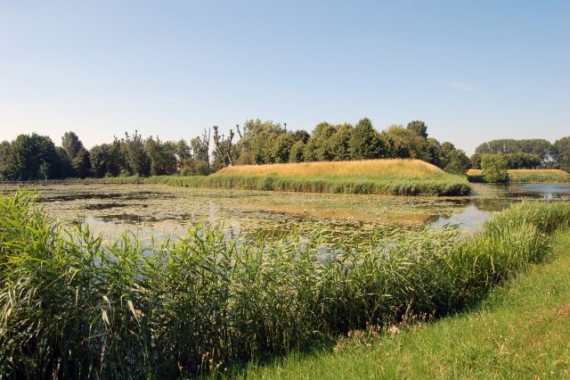
Das Fort Wierickerschans ist Teil der Alten Holländischen Wasserlinie (niederländisch Oude Hollandse Waterlinie). Dies war ein Verteidigungssystem, das es erlaubte, grosse Teile des Landes (Holland) zu überfluten, um die wichtigsten Städte im Westen vor angreifenden Kräften aus dem Osten zu schützen. Es war bis ins 19. Jahrhundert in Gebrauch. Das Fort wurde an der Stelle errichtet, an der Statthalter Wilhelm III. (Wilhelm von Oranien, der später König von England wurde) 1672 während des Krieges gegen Frankreich sein Hauptquartier hatte. Das Fort liegt zentral innerhalb der Alten Holländischen Wasserlinie, die sich von Muiden bis zum Biesbosch erstreckte.
Maschinell übersetzt aus „Wierickerschans“ in der englischsprachigen Wikipedia, CC BY-SA 4.0.
Wierickerschans steht weltweit auf Platz 6.714 von 8.134 im Burgen-Bekanntheitsranking des Atlas und Nr. 120 der 201 in den Niederlanden verzeichneten. Die Gründung fällt auf 1673 — früher als bei 25% der datierten Objekte des Atlas — eines von 626 Atlas-Objekten, die im 17. Jahrhundert gegründet wurden. Im Umkreis von 25 km stehen 19 weitere Objekte des Atlas. Der nächste Ausflugs-Guide ist Utrecht, 23 km entfernt. Sehen Sie in der Burgen-Statistik, wie die Niederlande abschneiden.
Auf der interaktiven Burgenkarte ansehen →Häufige Fragen
Wo liegt Wierickerschans?
Wierickerschans liegt in den Niederlanden, bei 52.08167°, 4.78333°.
Wann wurde Wierickerschans erbaut?
Der Atlas nennt als Gründungsjahr 1673. Frühere Anlagen mögen an dieser Stelle bestanden haben; dies ist das älteste dokumentierte Gründungsjahr.
Wie bekannt ist Wierickerschans?
Im Bekanntheitsranking dieses Atlas: Platz 6.714 von 8.134 weltweit, Platz 120 in den Niederlanden. Bekanntheit misst hier, in wie vielen Wikipedia-Sprachversionen ein Denkmal steht und wie oft diese gelesen werden.
Welche Burg liegt in der Nähe von Wierickerschans?
Groot Poelgeest, rund 14 km entfernt.
Weitere Burgen in den Niederlanden
- Burg Heeze Niederlande · 17. Jahrhundert
- Nijenborgh Castle Niederlande · 15. Jahrhundert
- Exaten Castle Niederlande · 16. Jahrhundert
- Castle Millen Niederlande · 14. Jahrhundert
Weitere Burgen
- Burg Dussen Niederlande · 12. Jahrhundert
- Kasteel IJsselstein Niederlande
- Kasteel Endegeest Niederlande · 14. Jahrhundert
- Burg Amasra Türkei