城
Wierickerschans
🇳🇱 オランダ · 17世紀
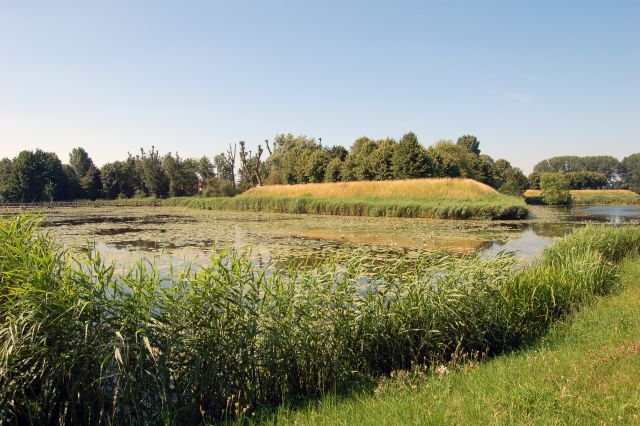
ウィーリッケルスハンス砦は、旧オランダ水防線("Oude Hollandse Waterlinie")の一部である。これは国土(ホラント)の広い部分を水没(湛水)させることを可能にした防衛システムであった。これにより、西部の主要な町や都市を東からの侵攻軍から守った。19世紀に至るまで使用されていた。この砦は、1672年にフランスとの戦争の際、総督ウィレム3世(オラニエ公ウィリアム、のちにイングランド王となる)が司令部を置いた場所に築かれた。砦はマイデンからビースボスまで延びる旧オランダ水防線の中央部に位置している。
英語版ウィキペディア「Wierickerschans」より機械翻訳、CC BY-SA 4.0。
Wierickerschansは、アトラスの城の知名度ランキングで世界6,714位(全8,134件中)、オランダの201件では120位にランクされています。1673年に創建され、アトラスの年代判明済みの城の25%より古い城です(17世紀に創建されたアトラス収録の626件のひとつ)。半径25キロ以内にはアトラス収録の城が19件あります。最寄りの日帰りガイドは23キロ先のユトレヒトです。オランダが他とどう比べられるかは、城の統計をご覧ください。
インタラクティブ地図で見る →よくある質問
Wierickerschansはどこにありますか?
オランダにあります。座標は52.08167°, 4.78333°です。
Wierickerschansはいつ建てられましたか?
アトラスが記録する創建は1673年です。これ以前の建造物が存在した可能性もありますが、これは記録に残る最も古い創建年です。
Wierickerschansはどれくらい有名ですか?
このアトラスの知名度ランキングでは全8,134件中6,714位(オランダでは120位)です。知名度は、ウィキペディアの言語版の数とその閲覧数を組み合わせた指標です。
Wierickerschansに最も近い城は?
Groot Poelgeestです。約14 km離れています。
オランダのその他の城
- ヘーゼ城 オランダ · 17世紀
- Nijenborgh Castle オランダ · 15世紀
- Exaten Castle オランダ · 16世紀
- Castle Millen オランダ · 14世紀
その他の城
- Dussen Castle オランダ · 12世紀
- Kasteel IJsselstein オランダ
- Kasteel Endegeest オランダ · 14世紀
- Amasra Castle トルコ