Fortaleza
Îles Saint-Marcouf
🇫🇷 Francia
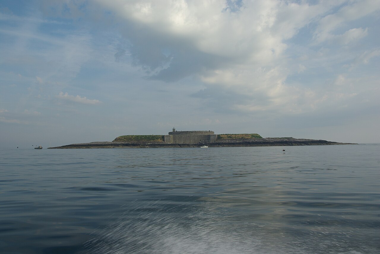
Las Îles Saint-Marcouf comprenden dos pequeñas islas deshabitadas frente a la costa de Normandía, Francia. Se encuentran en la región de la Baie de la Seine, en el canal de la Mancha, y están a 6,5 km (4,0 millas) al este de la costa de la península del Cotentin, en Ravenoville, y a 13 km (8 millas) de la isla de Tatihou y del puerto de Saint-Vaast-la-Hougue. Además de las fortificaciones descritas más abajo, en la isla mayor hay un faro que data de 1948.
La isla mayor, île du Large, está a 500 m (1.600 pies) al este de la más pequeña, île de Terre. Tienen una superficie total de 1.400 ha (3.500 acres) y una altitud máxima de 10 m (33 pies).
Las islas toman su nombre de san Marcouf, un santo nacido en Bayeux del que se decía que podía curar a cualquiera de escrófula. Murió en las Îles Saint-Marcouf el 1 de mayo del año 588. Hubo presencia monástica en las islas hasta el siglo XV.
Traducción automática de «Îles Saint-Marcouf» en la Wikipedia en inglés, CC BY-SA 4.0.
Îles Saint-Marcouf ocupa el puesto 2716 de 8134 en el mundo en la clasificación de fama de este atlas y el n.º 209 de los 525 que el atlas cartografía en Francia. Sus artículos de Wikipedia se abrieron 2779 veces en los últimos 60 días, más que el 74% del atlas. Figura entre los 17 monumentos del mapa regional «Normandía». Compara el dato en las estadísticas de castillos.
Ver en el mapa interactivo de castillos →Preguntas frecuentes
¿Dónde está Îles Saint-Marcouf?
La fortaleza se encuentra en Francia, en las coordenadas 49.49444°, -1.15°.
¿Qué puesto ocupa Îles Saint-Marcouf en la clasificación por fama?
En la clasificación por fama de este atlas: n.º 2716 de 8134 en el mundo, y n.º 209 en Francia. La fama combina en cuántas ediciones de Wikipedia aparece un monumento y cuánta gente las lee.
¿Qué castillo está más cerca de Îles Saint-Marcouf?
Château de Balleroy, a unos 42 km.
Más castillos en Francia
- Fort National Francia · siglo XVII
- Bastilla (Grenoble) Francia · siglo XIX
- Castillo de La Bussière Francia · siglo XVII
- Château de Miromesnil Francia · siglo XV
Más fortalezas
- Qila Mubarak, Patiala India
- Mileševac Fortress Serbia · siglo XV
- Krasnaya Gorka Fort Rusia · siglo XX
- Tarakanivskiy Fort Ucrania · siglo XIX