Vesting
Îles Saint-Marcouf
🇫🇷 Frankrijk
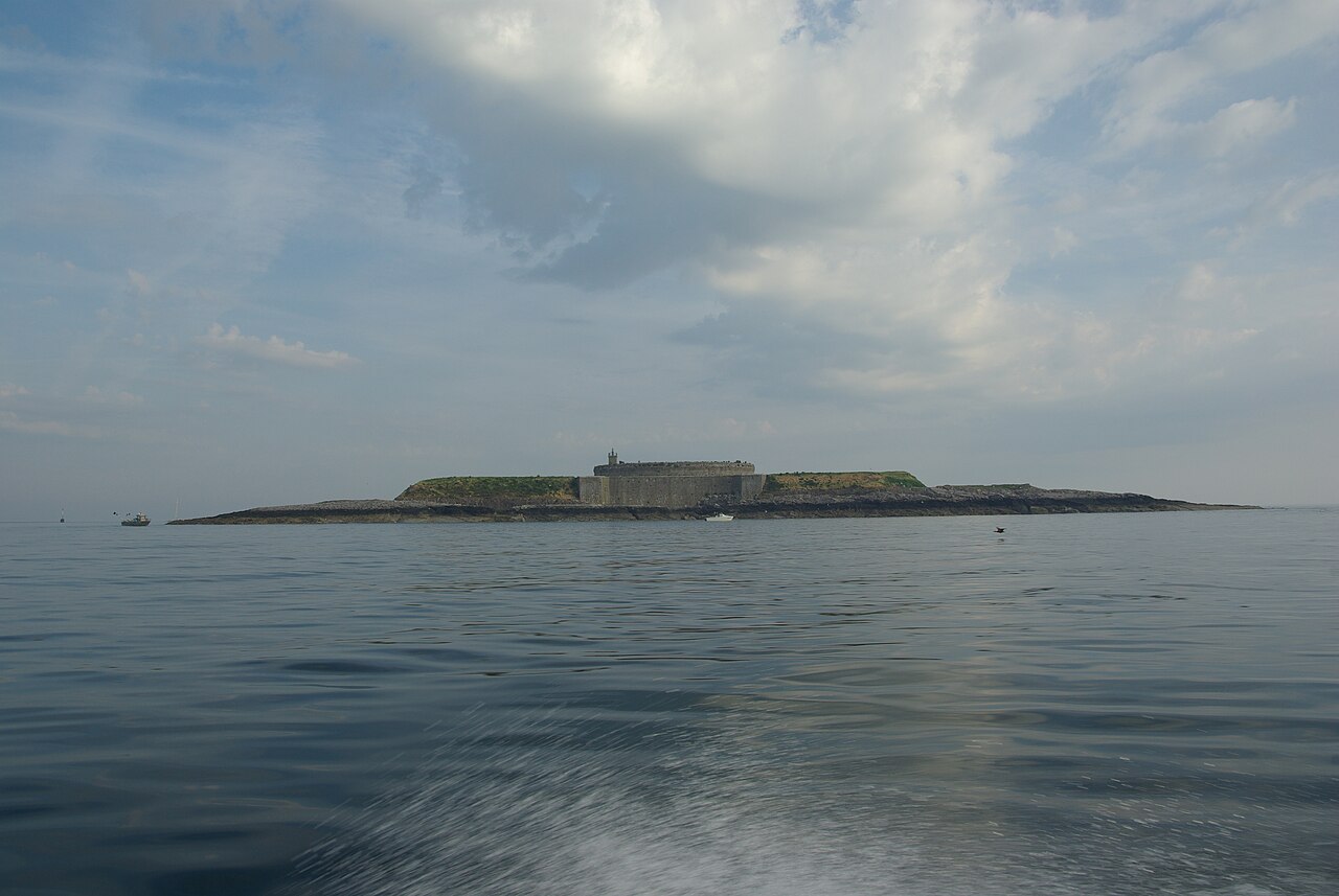
De Îles Saint-Marcouf bestaan uit twee kleine onbewoonde eilanden voor de kust van Normandië, Frankrijk. Ze liggen in de Baie de la Seine in het Kanaal en bevinden zich 6,5 km ten oosten van de kust van het schiereiland Cotentin bij Ravenoville en 13 km van het eiland Tatihou en de haven van Saint-Vaast-la-Hougue. Naast de hieronder beschreven vestingwerken staat op het grotere eiland een vuurtoren die dateert uit 1948.
Het grotere eiland, île du Large, ligt 500 m ten oosten van het kleinere île de Terre. Samen hebben ze een oppervlakte van 1.400 ha en een maximale hoogte van 10 m.
De eilanden zijn genoemd naar Sint-Marcouf, een heilige geboren in Bayeux, van wie men zei dat hij iedereen van klierziekte (scrofulose) kon genezen. Hij stierf op de Îles Saint-Marcouf op 1 mei 588. Tot in de 15e eeuw was er een monastieke aanwezigheid op de eilanden.
Machinaal vertaald uit “Îles Saint-Marcouf” op de Engelstalige Wikipedia, CC BY-SA 4.0.
Îles Saint-Marcouf staat op plaats 2.716 van 8.134 in de bekendheidsranglijst van deze atlas en op plaats 209 van de 525 die de atlas in Frankrijk in kaart brengt. De Wikipedia-artikelen erover werden de afgelopen 60 dagen 2.779 keer geopend, meer dan 74% van de atlas. Dit is een van de 17 bouwwerken op de regiokaart Normandië. Zie hoe dat zich verhoudt in de kastelenstatistiek.
Bekijk op de interactieve kastelenkaart →Veelgestelde vragen
Waar ligt Îles Saint-Marcouf?
Îles Saint-Marcouf ligt in Frankrijk, op 49.49444°, -1.15°.
Hoe bekend is Îles Saint-Marcouf?
In de bekendheidsranglijst van deze atlas: plaats 2.716 van 8.134 wereldwijd, plaats 209 in Frankrijk. Bekendheid combineert het aantal Wikipedia-taalversies met het aantal lezers.
Welk kasteel ligt het dichtst bij Îles Saint-Marcouf?
Het Kasteel van Balleroy, ongeveer 42 km verderop.
Meer kastelen in Frankrijk
- Fort National Frankrijk · 17e eeuw
- Bastille (Grenoble) Frankrijk · 19e eeuw
- Château de La Bussière Frankrijk · 17e eeuw
- Kasteel van Miromesnil Frankrijk · 15e eeuw
Meer vestingen
- Qila Mubarak, Patiala India
- Mileševac Servië · 15e eeuw
- Krasnaya Gorka Fort Rusland · 20e eeuw
- Tarakanivskiy Fort Oekraïne · 19e eeuw