Twierdza
Îles Saint-Marcouf
🇫🇷 Francja
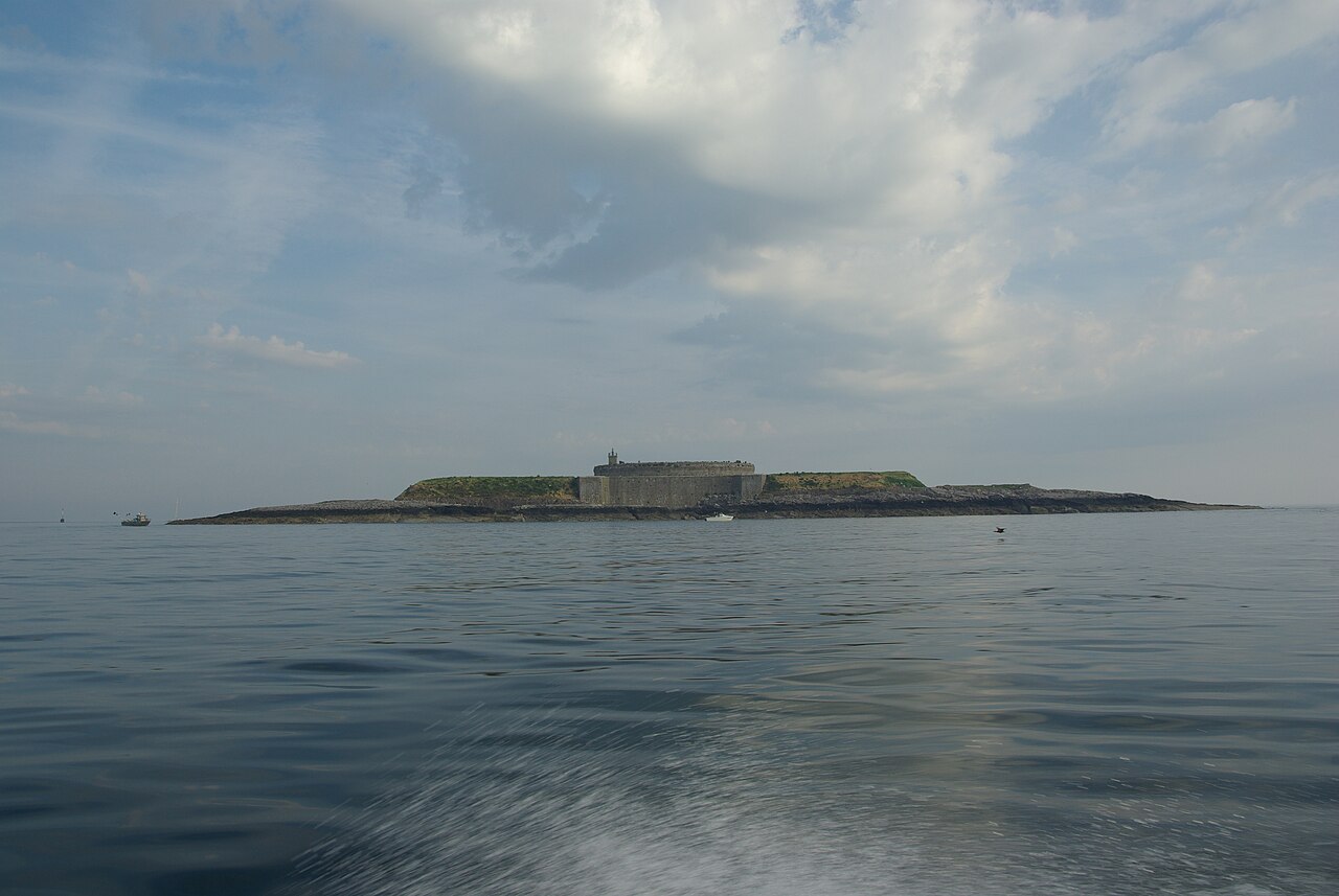
Îles Saint-Marcouf to dwie małe niezamieszkane wyspy u wybrzeży Normandii we Francji. Leżą w regionie Baie de la Seine kanału La Manche, 6,5 km (4,0 mile) na wschód od wybrzeża półwyspu Cotentin przy Ravenoville i 13 km (8 mil) od wyspy Tatihou oraz portu w Saint-Vaast-la-Hougue. Oprócz opisanych poniżej umocnień, na większej wyspie znajduje się latarnia morska pochodząca z 1948 roku.
Większa wyspa, île du Large, leży 500 m (1600 stóp) na wschód od mniejszej île de Terre. Ich łączna powierzchnia wynosi 1400 ha (3500 akrów), a maksymalna wysokość 10 m (33 stopy).
Wyspy wzięły nazwę od świętego Marcouf, świętego urodzonego w Bayeux, o którym mówiono, że potrafi uleczyć każdego ze skrofulozy. Zmarł na wyspach Îles Saint-Marcouf 1 maja 588 roku n.e. Na wyspach istniała obecność zakonna aż do XV wieku.
Tłumaczenie maszynowe artykułu „Îles Saint-Marcouf” w angielskiej Wikipedii, CC BY-SA 4.0.
Îles Saint-Marcouf zajmuje 2716. miejsce na 8134 w rankingu rozpoznawalności zamków tego atlasu i 209. wśród 525 obiektów we Francji. Artykuły o tym obiekcie w Wikipedii otwarto 2779 razy w ciągu ostatnich 60 dni — więcej niż 74% obiektów atlasu. Jest jednym z 17 obiektów na mapie regionalnej „Normandia”. Zobacz w statystykach zamków, jak wypada Francja.
Zobacz na interaktywnej mapie zamków →Najczęstsze pytania
Gdzie znajduje się Îles Saint-Marcouf?
Îles Saint-Marcouf znajduje się we Francji, na współrzędnych 49.49444°, -1.15°.
Które miejsce w rankingu zajmuje Îles Saint-Marcouf?
W rankingu rozpoznawalności tego atlasu: 2716. miejsce na 8134, 209. miejsce we Francji. Rozpoznawalność łączy liczbę wersji językowych Wikipedii z liczbą czytelników.
Îles Saint-Marcouf — który zamek leży najbliżej?
Château de Balleroy, około 42 km stąd.
Inne zamki we Francji
- Fort National Francja · XVII wiek
- Bastille (Grenoble) Francja · XIX wiek
- Château de La Bussière Francja · XVII wiek
- Château de Miromesnil Francja · XV wiek
Inne obiekty: twierdze
- Qila Mubarak, Patiala Indie
- Mileševac Fortress Serbia · XV wiek
- Fort Krasnaja Gorka Rosja · XX wiek
- Fort w Tarakanowie Ukraina · XIX wiek