Ruïne
Amberd
🇦🇲 Armenië · 10e eeuw
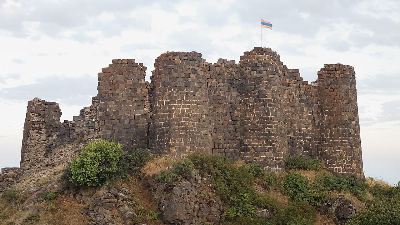
Amberd (Armeens: Ամբերդ) is een 10e-eeuws fort op 2.300 meter boven zeeniveau, op de hellingen van de berg Aragats, bij de samenvloeiing van de rivieren Arkashen en Amberd, in de provincie Aragatsotn, Armenië. De naam betekent "fort in de wolken" in het Armeens. De naam wordt ook, ten onrechte, toegeschreven aan de Vahramashenkerk, de 11e-eeuwse Armeense kerk nabij het kasteel. Het dorp Byurakan ligt 6,4 km van de plaats waar Amberd staat.
In 2024 plaatste de pan-Europese Federatie voor Cultureel Erfgoed Europa Nostra Amberd, een middeleeuws fort, op de lijst van de 7 meest bedreigde Europese monumenten en erfgoedplaatsen. De gebouwen van het complex dreigen in te storten door ouderdom, gebrek aan financiering voor de versteviging van de constructies, en door erosie en aardbevingen.
Machinaal vertaald uit “Amberd” op de Engelstalige Wikipedia, CC BY-SA 4.0.
Amberd staat op plaats 702 van 8.134 in de bekendheidsranglijst van deze atlas en op plaats 2 van de 28 die de atlas in Armenië in kaart brengt. Gebouwd in ca. 1000, en daarmee ouder dan 92% van de gedateerde bouwwerken in de atlas — een van de 138 bouwwerken in de atlas die uit de 10e eeuw stammen. De Wikipedia-artikelen erover werden de afgelopen 60 dagen 6.219 keer geopend, meer dan 88% van de atlas. Binnen 25 km staan nog 3 andere bouwwerken uit de atlas. De dichtstbijzijnde dagtripgids is Jerevan, 34 km verderop. Zie hoe dat zich verhoudt in de kastelenstatistiek.
Bekijk op de interactieve kastelenkaart →Veelgestelde vragen
Waar ligt Amberd?
Amberd ligt in Armenië, op 40.38873°, 44.22653°.
Wanneer werd Amberd gebouwd?
De atlas dateert de stichting op ca. 1000. Er kunnen eerdere bouwwerken hebben gestaan; dit is het oudste gedocumenteerde bouwjaar.
Hoe bekend is Amberd?
In de bekendheidsranglijst van deze atlas: plaats 702 van 8.134 wereldwijd, plaats 2 in Armenië. Bekendheid combineert het aantal Wikipedia-taalversies met het aantal lezers.
Welk kasteel ligt het dichtst bij Amberd?
Aghchka berd, ongeveer 11 km verderop.
Meer kastelen in Armenië
- Erivan Fortress Armenië · 16e eeuw
- Smbataberd Armenië · 5e eeuw
- Baghaberd Armenië · 4e eeuw
- Halidzor Fortress Armenië · 17e eeuw
Meer ruïnes
- Rhuddlan Castle Wales · 13e eeuw
- Kasteel van Kenilworth Engeland · 12e eeuw
- Vindolanda Engeland · 1e eeuw
- Babak-kasteel Iran · 9e eeuw