Ruïne
Castro de Baroña
Castro of Baroña · 🇪🇸 Spanje
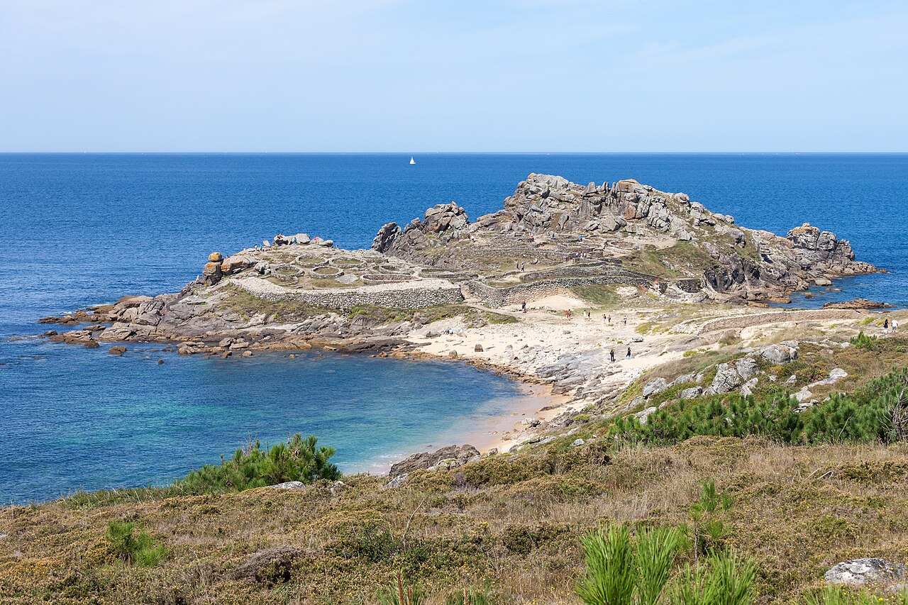
De Castro de Baroña is een versterkte nederzetting uit de ijzertijd in de parochie Baroña, gemeente Porto do Son, in de provincie A Coruña (Galicië, Spanje. GPS-coördinaten: 42°41'41,40"N 9°1'57,10"W). De nederzetting, omringd door twee muren en met twintig ronde huizen die nog steeds bestaan, werd gebouwd op een schiereiland en was bewoond van de 1e eeuw v.Chr. tot de 1e eeuw n.Chr.
Een gracht van vier meter breed en drie meter diep, de eerste verdedigingslinie, werd gegraven in de landengte die de stad met het fort verbindt. Daarachter bevindt zich een wal bestaande uit twee bijna evenwijdige stenen muren, gevuld met zand en steen. Men denkt dat deze wal oorspronkelijk aansloot op de stadsmuren, waardoor een gebied ontstond dat vermoedelijk geen bebouwing had.
De hoofdmuur is goed bewaard gebleven en heeft twee zijden: de rechterzijde bestaat uit drie geleidelijk oplopende stenen muren, en de linkerzijde lijkt op die van de landengte. Rechts van de ingang bevond zich een verdedigingstoren waar de muren versmalden, wat doet vermoeden dat hier een poort was om de doorgang van karren te verhinderen. Mogelijk omgaf de muur voorheen het gehele fort.
Er is een hellende ingang die naar de binnenruimte leidt, die is opgedeeld in vier afzonderlijke delen. Over het eerste deel wordt betwist of de constructie aan de linkerzijde een lange bank of één enkele omgevallen zuil is. Binnen dit gebouw werden een haard, aardewerken voorwerpen en een gat voor een paal gevonden, wat erop wijst dat het een smederij kan zijn geweest. Tegen de poort aan staan andere ovaalvormige structuren met een zaal en nog een structuur die mogelijk een smederij was.
Het volgende gedeelte wordt gescheiden door een keermuur en is bereikbaar via een trap, die de best bewaarde is van alle Galicische forten. Dit gedeelte bevat een groep huizen die een tegen de wind beschutte ruimte vormen.
Een pad leidt naar het hoogste deel van de stad, waar zich nog andere bewaard gebleven structuren bevinden.
Bewijzen wijzen erop dat de stad zelfvoorzienend was. Binnen het fort was geen water, geen bronnen of putten, waardoor water elders gehaald moest worden. Men denkt dat het voedsel vooral uit zee kwam en dus voornamelijk uit schaal- en schelpdieren en vis bestond. Ook aten de bewoners rundvee, geiten, schapen en eikels.
Op de vindplaats zijn resten van metaalbewerking, metselwerk en textiel aangetroffen.
Machinaal vertaald uit “Castro de Baroña” op de Engelstalige Wikipedia, CC BY-SA 4.0.
Castro de Baroña staat op plaats 1.832 van 8.134 in de bekendheidsranglijst van deze atlas en op plaats 66 van de 602 die de atlas in Spanje in kaart brengt. De Wikipedia-artikelen erover werden de afgelopen 60 dagen 4.260 keer geopend, meer dan 82% van de atlas. Binnen 25 km staan nog 3 andere bouwwerken uit de atlas. Zie hoe dat zich verhoudt in de kastelenstatistiek.
Bekijk op de interactieve kastelenkaart →Veelgestelde vragen
Waar ligt Castro de Baroña?
Castro de Baroña ligt in Spanje, op 42.69494°, -9.03222°.
Hoe bekend is Castro de Baroña?
In de bekendheidsranglijst van deze atlas: plaats 1.832 van 8.134 wereldwijd, plaats 66 in Spanje. Bekendheid combineert het aantal Wikipedia-taalversies met het aantal lezers.
Welk kasteel ligt het dichtst bij Castro de Baroña?
Castro de Achadizo, ongeveer 15 km verderop.
Meer kastelen in Spanje
- Arco de Santa María Spanje · 16e eeuw
- Puerta Bab al-Mardum Spanje · 10e eeuw
- Puerta de Bisagra Spanje · 16e eeuw
- Castle of the Calatravos Spanje
Meer ruïnes
- Findlater Castle Schotland · 13e eeuw
- Kumma Soedan
- Qasr Banat Libië · 3e eeuw
- Žovnek Castle Slovenië · 13e eeuw