Ruin
Castro of Baroña
🇪🇸 Spain
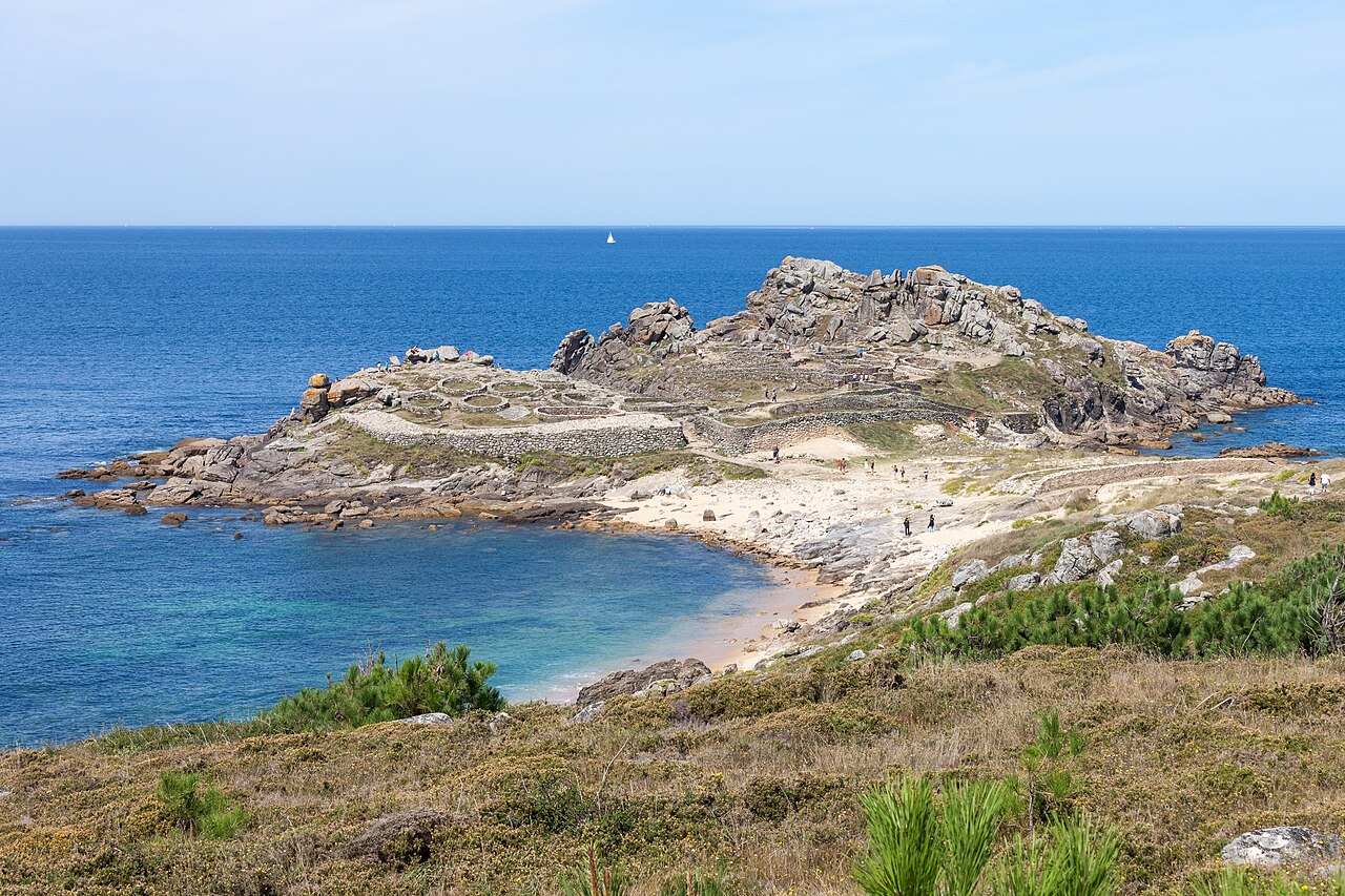
The Castro de Baroña is an Iron Age fortified settlement located in the parish of Baroña, a municipality of Porto do Son in the province of A Coruña (Galicia, Spain. GPS Co-ordinates: 42°41'41.40"N 9°1'57.10"W). The settlement, surrounded by two walls and containing twenty roundhouses that still remain today, was built on a peninsula and inhabited from the 1st century BC to the 1st century AD.
A moat four metres wide by three metres deep, forming the first line of defence, was dug into the isthmus that connects the town to the fort. Beyond this, there is a rampart consisting of two almost parallel stone walls filled with sand and stone. It is thought that this rampart originally connected to the town walls, creating an area most likely without housing.
The main wall is well preserved and has two sides, the one on the right is made up of three gradually rising stone walls, and the one on the left is similar to that of the isthmus. To the right of the entrance there was a defensive tower where the walls narrowed, so it is assumed that it was shut with a gate to prevent the passage of carts. It is possible that the wall previously surrounded the entire fort.
There is a sloped entrance that leads into the interior living space, which is divided into four separate parts. In the first, it is debated whether the construction on the left is either a long bench or a single fallen pillar. Within this building a fireplace, some earthenware artefacts and a hole for a post were found, indicating it could have been a forge. Set against the gate, there are other oval shaped structures with a hall and another that could have been a forge.
The next section is separated by a retaining wall and is reached by some stairs, which are the best preserved of all Galician forts. This section contains a group of houses forming an area sheltered from the wind.
A trail leads to the highest part of the town where there are other surviving structures.
Evidence suggests the town was self-sufficient. Inside the fort there was no water, springs or wells, thus there was the need to source water elsewhere. It is thought that food came primarily from the sea, and so basically consisted in shellfish and fish. They also ate cattle, goats, sheep and acorns.
At the site there are remains of metalwork, masonry and textiles.
Text adapted from “Castro de Baroña” on Wikipedia, CC BY-SA 4.0.
Castro of Baroña ranks #1,832 of 8,134 worldwide in the atlas's castle fame ranking, and #66 of the 602 mapped in Spain. Its Wikipedia articles were opened 4,260 times in the last 60 days, more than 82% of the atlas. 3 more atlas landmarks stand within 25 km. See how Spain compares in the castle statistics.
View on the interactive castle map →Frequently asked questions
Where is Castro of Baroña?
Castro of Baroña stands in Spain, at 42.69494°, -9.03222°.
How famous is Castro of Baroña?
In this atlas's fame ranking: #1,832 of 8,134 worldwide, and #66 in Spain. Fame here combines how many Wikipedia language editions cover a landmark with how many people read them.
What is the nearest castle to Castro of Baroña?
Castro de Achadizo, about 15 km away.
More castles in Spain
- Arco de Santa María Spain · 16th century
- Puerta Bab al-Mardum Spain · 10th century
- Puerta de Bisagra Spain · 16th century
- Castle of the Calatravos Spain
More ruins
- Findlater Castle Scotland · 13th century
- Kumma Sudan
- Gasr Banat Libya · 3rd century
- Žovnek Castle Slovenia · 13th century