Vesting
Fort Ticonderoga
🇺🇸 Verenigde Staten · 18e eeuw
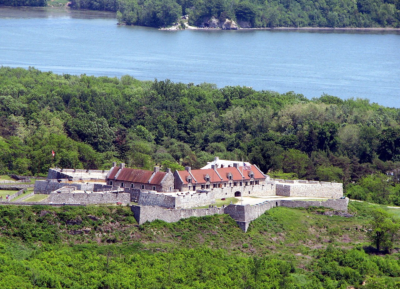
Fort Ticonderoga, voorheen Fort Carillon, is een groot 18e-eeuws stervormig fort dat door de Fransen werd gebouwd bij een engte nabij het zuidelijke uiteinde van Lake Champlain in het noorden van de staat New York. Het werd gebouwd tussen oktober 1755 en 1757 door de Frans-Canadese militaire ingenieur Michel Chartier de Lotbinière, markies de Lotbinière, tijdens de Noord-Amerikaanse fase van de Zevenjarige Oorlog, in de Verenigde Staten bekend als de French and Indian War. Het fort was van strategisch belang tijdens de 18e-eeuwse koloniale conflicten tussen Groot-Brittannië en Frankrijk, en speelde opnieuw een belangrijke rol tijdens de Amerikaanse Onafhankelijkheidsoorlog.
De locatie beheerste een rivierportage langs de monding van de snelstromende La Chute-rivier, in de 3,5 mijl (5,6 km) tussen Lake Champlain en Lake George. Zij lag strategisch ten opzichte van de handelsroutes tussen de door de Britten beheerste vallei van de Hudson en de door de Fransen beheerste vallei van de Saint Lawrence. Het terrein versterkte het belang van de locatie. Beide meren waren lang en smal en noord-zuid georiënteerd, evenals de vele bergkammen van de Appalachen, die zich tot in Georgia in het zuiden uitstrekken. De bergen vormden nagenoeg onbegaanbaar terrein ten oosten en westen van de Great Appalachian Valley die de locatie beheerste. De naam "Ticonderoga" komt van het Irokese woord tekontaró:ken, dat "het is bij de samenvloeiing van twee waterwegen" betekent.
Tijdens de Slag bij Carillon in 1758 slaagden 4.000 Franse verdedigers erin een aanval van 16.000 Britse troepen af te slaan. In 1759 keerden de Britten terug en verdreven zij een symbolisch Frans garnizoen uit het fort. De Britten beheersten het fort aan het begin van de Onafhankelijkheidsoorlog, maar de Green Mountain Boys en andere staatsmilities onder bevel van Ethan Allen en Benedict Arnold veroverden het op 10 mei 1775.
Machinaal vertaald uit “Fort Ticonderoga” op de Engelstalige Wikipedia, CC BY-SA 4.0.
Fort Ticonderoga staat op plaats 353 van 8.134 in de bekendheidsranglijst van deze atlas en op plaats 6 van de 103 die de atlas in de Verenigde Staten in kaart brengt. Gebouwd in 1754, en daarmee ouder dan 17% van de gedateerde bouwwerken in de atlas — een van de 556 bouwwerken in de atlas die uit de 18e eeuw stammen. De Wikipedia-artikelen erover werden de afgelopen 60 dagen 38.979 keer geopend, meer dan 99% van de atlas. Binnen 25 km staan nog 2 andere bouwwerken uit de atlas. Zie hoe dat zich verhoudt in de kastelenstatistiek.
Bekijk op de interactieve kastelenkaart →Veelgestelde vragen
Waar ligt Fort Ticonderoga?
Fort Ticonderoga ligt in de Verenigde Staten, op 43.84167°, -73.3875°.
Wanneer werd Fort Ticonderoga gebouwd?
De atlas dateert de stichting op 1754. Er kunnen eerdere bouwwerken hebben gestaan; dit is het oudste gedocumenteerde bouwjaar.
Hoe bekend is Fort Ticonderoga?
In de bekendheidsranglijst van deze atlas: plaats 353 van 8.134 wereldwijd, plaats 6 in de Verenigde Staten. Bekendheid combineert het aantal Wikipedia-taalversies met het aantal lezers.
Welk kasteel ligt het dichtst bij Fort Ticonderoga?
Fort Crown Point, ongeveer 21 km verderop.
Meer kastelen in de Verenigde Staten
- Fort McHenry Verenigde Staten · 18e eeuw
- Fort Duquesne Verenigde Staten · 18e eeuw
- Boldt Castle Verenigde Staten · 20e eeuw
- Fort Caroline Verenigde Staten · 16e eeuw
Meer vestingen
- Castillo de la Real Fuerza Cuba · 16e eeuw
- Koulés Griekenland · 16e eeuw
- Shivneri Fort India
- Vesting Coburg Duitsland · 13e eeuw