 United States · 18th century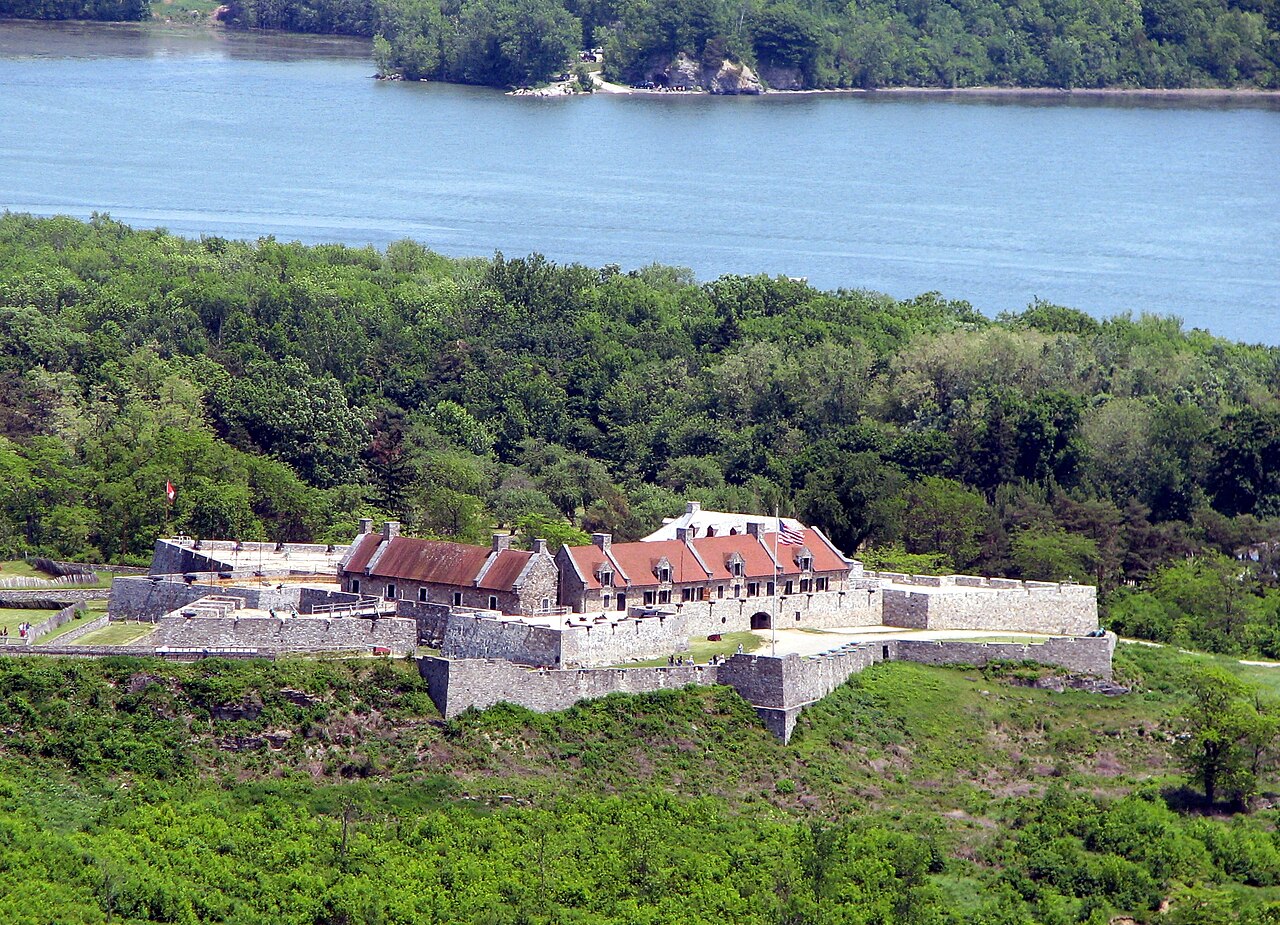
Fort Ticonderoga, formerly Fort Carillon, is a large 18th-century star fort built by the French at a narrows near the south end of Lake Champlain in northern New York. It was constructed between October 1755 and 1757 by French-Canadian military engineer Michel Chartier de Lotbinière, Marquis de Lotbinière during the North American phase of the Seven Years' War, known in the United States as the French and Indian War. The fort was of strategic importance during the 18th-century colonial conflicts between Great Britain and France, and again played an important role during the American Revolutionary War.
The site controlled a river portage alongside the mouth of the rapid La Chute River, in the 3.5 miles (5.6 km) between Lake Champlain and Lake George. It was strategically placed for the trade routes between the British-controlled Hudson River Valley and the French-controlled Saint Lawrence River Valley. The terrain amplified the importance of the site. Both lakes were long and narrow and oriented north–south, as were the many ridge lines of the Appalachian Mountains which extend as far south as Georgia. The mountains created nearly impassable terrains to the east and west of the Great Appalachian Valley that the site commanded. The name "Ticonderoga" comes from the Iroquois word tekontaró:ken, meaning "it is at the junction of two waterways".
During the 1758 Battle of Carillon, 4,000 French defenders were able to repel an attack by 16,000 British troops. In 1759, the British returned and drove a token French garrison from the fort. The British controlled the fort at the beginning of the Revolutionary War, but the Green Mountain Boys and other state militia under the command of Ethan Allen and Benedict Arnold captured it on May 10, 1775.
Text adapted from “Fort Ticonderoga” on Wikipedia, CC BY-SA 4.0.
Fort Ticonderoga ranks #345 of 9,079 worldwide in the atlas's castle fame ranking, and #6 of the 110 mapped in United States. Founded 1754, it is older than 16% of the atlas's dated landmarks — one of 696 atlas entries founded in the 18th century. Its Wikipedia articles were opened 38,979 times in the last 60 days, more than 99% of the atlas. 2 more atlas landmarks stand within 25 km. See how United States compares in the castle statistics.
View on the interactive castle map →