Ruïne
Qalʿat ar-Rahba
🇸🇾 Syrië · 13e eeuw
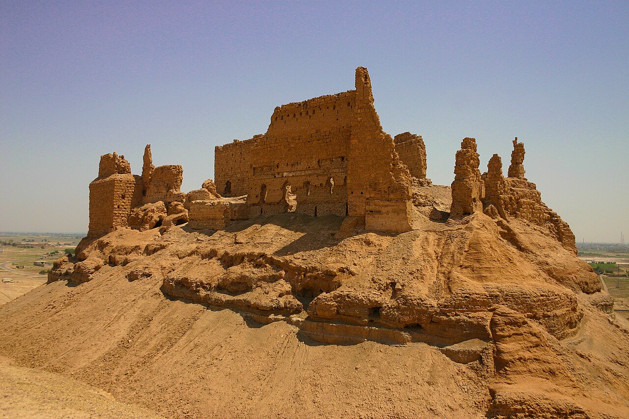
Al-Rahba (ALA-LC: al-Raḥba, ook wel gespeld als Raḥabah), ook bekend als Qal'at al-Rahba (قلعة الرحبة), wat vertaald "Citadel van al-Rahba" betekent, is een middeleeuwse Arabische vesting aan de westelijke oever van de Eufraat, naast de stad Mayadin in Syrië. Gelegen op een heuvel met een hoogte van 244 meter (801 voet) overziet al-Rahba de Syrische woestijnsteppe. Het is omschreven als "een vesting binnen een vesting"; het bestaat uit een binnenste donjon van 60 bij 30 meter (197 bij 98 voet), beschermd door een omwalling van 270 bij 95 meter (886 bij 312 voet). Al-Rahba ligt tegenwoordig grotendeels in ruïnes als gevolg van winderosie.
De oorspronkelijke vesting, bekend als "Rahbat Malik ibn Tawk" naar haar Abbasidische naamgever en stichter, lag aan de Eufraat. Moslimlegers, karavanen en reizigers beschouwden haar als de sleutel tot Syrië vanuit Irak, en soms andersom. Bedoeïenenstammen namen er vaak de controle over en gebruikten haar als uitvalsbasis voor invasies van Noord-Syrië. Vanwege haar strategische ligging werd om al-Rahba veelvuldig gestreden door islamitische machten, waaronder lokale heersers, de Hamdaniden, de Uqailiden, de Mirdasiden en de Seltsjoeken, onder anderen. Rahbat Malik ibn Tawk werd in 1157 door een aardbeving verwoest.
Enkele jaren later werd de huidige vesting dicht bij de rand van de woestijn gebouwd door de Zengidisch-Ayyubidische heer Shirkuh. Diens nakomelingen hielden al-Rahba als erfelijk leen, verleend door Saladin, tot 1264. Een van hen, Shirkuh II, hield in 1207 toezicht op een derde grote wederopbouw. Gedurende de vroege Mammelukse periode (late 13e–14e eeuw) werd de vesting voortdurend hersteld en versterkt als gevolg van herhaalde belegeringen door de Ilchaniden-Mongolen uit Irak. Al-Rahba was de belangrijkste Mammelukse vesting langs de Eufraat, een bestuurscentrum en het eindstation van de postroute van het sultanaat.
Machinaal vertaald uit “Al-Rahba” op de Engelstalige Wikipedia, CC BY-SA 4.0.
Qalʿat ar-Rahba staat op plaats 2.932 van 8.134 in de bekendheidsranglijst van deze atlas en op plaats 19 van de 38 die de atlas in Syrië in kaart brengt. Gebouwd in 1207, en daarmee ouder dan 76% van de gedateerde bouwwerken in de atlas — een van de 861 bouwwerken in de atlas die uit de 13e eeuw stammen. De Wikipedia-artikelen erover werden de afgelopen 60 dagen 1.222 keer geopend, meer dan 54% van de atlas. Dit is een van de 113 bouwwerken op de regiokaart de Levant. Zie hoe dat zich verhoudt in de kastelenstatistiek.
Bekijk op de interactieve kastelenkaart →Veelgestelde vragen
Waar ligt Qalʿat ar-Rahba?
Qalʿat ar-Rahba ligt in Syrië, op 35.00496°, 40.42323°.
Wanneer werd Qalʿat ar-Rahba gebouwd?
De atlas dateert de stichting op 1207. Er kunnen eerdere bouwwerken hebben gestaan; dit is het oudste gedocumenteerde bouwjaar.
Hoe bekend is Qalʿat ar-Rahba?
In de bekendheidsranglijst van deze atlas: plaats 2.932 van 8.134 wereldwijd, plaats 19 in Syrië. Bekendheid combineert het aantal Wikipedia-taalversies met het aantal lezers.
Welk kasteel ligt het dichtst bij Qalʿat ar-Rahba?
Royal Palace of Mari, ongeveer 66 km verderop.
Meer kastelen in Syrië
- Azm Palace (Hama) Syrië · 18e eeuw
- Qal'at Najm Syrië · 7e eeuw
- Ba'rin Syrië · 12e eeuw
- Areimeh Castle Syrië
Meer ruïnes
- Kasteel van Ludza Letland · 14e eeuw
- Maizuru Castle Park Japan · 16e eeuw
- Nagoya Castle (Hizen Province) Japan · 16e eeuw
- Minowa Castle Japan · 16e eeuw