 Syria · 13th century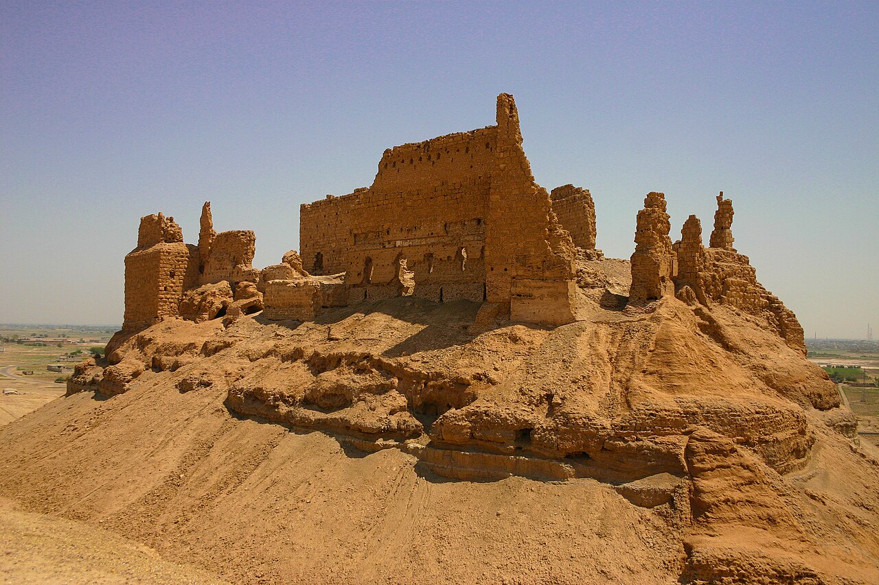
Al-Rahba (/ALA-LC: al-Raḥba, sometimes spelled Raḥabah), also known as Qal'at al-Rahba (قلعة الرحبة), which translates as the "Citadel of al-Rahba", is a medieval Arab fortress on the west bank of the Euphrates River, adjacent to the city of Mayadin in Syria. Situated atop a mound with an elevation of 244 meters (801 ft), al-Rahba oversees the Syrian Desert steppe. It has been described as "a fortress within a fortress"; it consists of an inner keep measuring 60 by 30 meters (197 ft × 98 ft), protected by an enclosure measuring 270 by 95 meters (886 ft × 312 ft). Al-Rahba is largely in ruins today as a result of wind erosion.
The original site, which was known as "Rahbat Malik ibn Tawk" after its Abbasid namesake and founder, was located along the Euphrates. It was viewed by Muslim armies, caravans and travelers as the key to Syria from Iraq and sometimes vice versa. Bedouin tribes often took control of it and used it as a launching point for invasions of northern Syria. Because of its strategic location, al-Rahba was frequently fought over by Muslim powers, including local lords, the Hamdanids, the Uqaylids, the Mirdasids and the Seljuks, among others. Rahbat Malik ibn Tawk was destroyed in an earthquake in 1157.
A few years later, the current fortress was built close to the desert edge by the Zengid–Ayyubid lord Shirkuh. The latter's descendants held al-Rahba as a hereditary fief granted by Saladin until 1264. One of them, Shirkuh II, oversaw a third major reconstruction in 1207. Through the early Mamluk era (late 13th–14th centuries), the fortress was continuously restored and strengthened as a result of frequent sieges by the Ilkhanid Mongols of Iraq. Al-Rahba was the most important Mamluk fortress along the Euphrates, an administrative center and the terminal stop on the sultanate's postal route.
Text adapted from “Al-Rahba” on Wikipedia, CC BY-SA 4.0.
Qalʿat ar-Rahba ranks #2,922 of 9,079 worldwide in the atlas's castle fame ranking, and #18 of the 38 mapped in Syria. Founded 1207, it is older than 74% of the atlas's dated landmarks — one of 1080 atlas entries founded in the 13th century. Its Wikipedia articles were opened 1,222 times in the last 60 days, more than 56% of the atlas. It is one of the 106 landmarks on the atlas's regional map of the Levant. See how Syria compares in the castle statistics.
View on the interactive castle map →