Ruina
Castro of Santa Trega
🇪🇸 Hiszpania
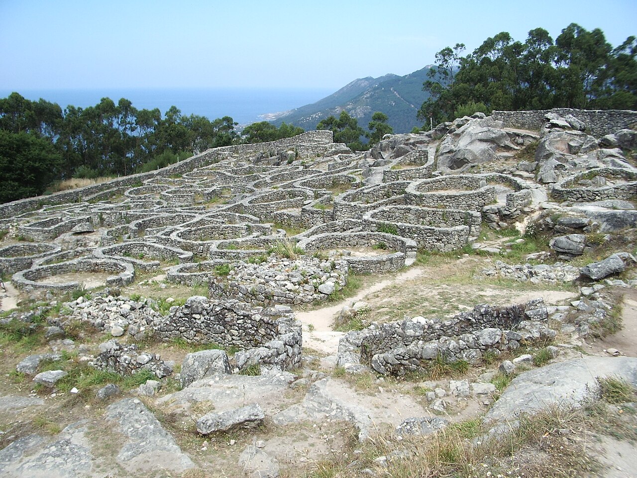
Castro Santa Trega to stanowisko archeologiczne na zboczach góry Santa Trega, w położonej na południowym zachodzie Galicji gminie A Guarda w Hiszpanii. Stanowisko zajmuje strategiczne położenie nad ujściem rzeki Miño, na wysokości 341 metrów (1118 stóp) n.p.m. Należąc do kultury castro, jest jednym z najbardziej symbolicznych i najczęściej odwiedzanych galicyjskich grodzisk (castros).
W 1931 roku zostało uznane za Narodowy Zabytek Historyczno-Artystyczny („Monumento Histórico Artístico Nacional”), a także uznane za Dobro Interesu Kulturowego („Bien de Interés Cultural”: BIC).
Tłumaczenie maszynowe artykułu „Castro of Santa Trega” w angielskiej Wikipedii, CC BY-SA 4.0.
Castro of Santa Trega zajmuje 1721. miejsce na 8134 w rankingu rozpoznawalności zamków tego atlasu i 61. wśród 602 obiektów w Hiszpanii. Artykuły o tym obiekcie w Wikipedii otwarto 3804 razy w ciągu ostatnich 60 dni — więcej niż 80% obiektów atlasu. W promieniu 25 km stoi 4 innych obiektów atlasu. Najbliższy przewodnik na jednodniowy wypad to Viana do Castelo, 22 km stąd. Zobacz w statystykach zamków, jak wypada Hiszpania.
Zobacz na interaktywnej mapie zamków →Najczęstsze pytania
Gdzie znajduje się Castro of Santa Trega?
Castro of Santa Trega znajduje się w Hiszpanii, na współrzędnych 41.89275°, -8.86981°.
Które miejsce w rankingu zajmuje Castro of Santa Trega?
W rankingu rozpoznawalności tego atlasu: 1721. miejsce na 8134, 61. miejsce w Hiszpanii. Rozpoznawalność łączy liczbę wersji językowych Wikipedii z liczbą czytelników.
Castro of Santa Trega — który zamek leży najbliżej?
Forte da Ínsua, około 4 km stąd.
Inne zamki w Hiszpanii
- Puerta del Sol (Toledo) Hiszpania
- Royal Walls Hiszpania · X wiek
- Castle of Lorca Hiszpania · IX wiek
- Alcazaba of Badajoz Hiszpania · IX wiek
Inne obiekty: ruiny
- Sandby borg Szwecja
- Châteaux de Lastours Francja
- Tschanüff Castle Szwajcaria · XII wiek
- Pałac Letni w Petersburgu Rosja · XVIII wiek