Ruïne
Castro of Santa Trega
🇪🇸 Spanje
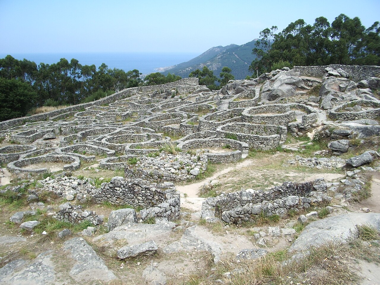
Het Castro van Santa Trega is een archeologische vindplaats op de hellingen van de berg Santa Trega, in de zuidwestelijke Galicische gemeente A Guarda, Spanje. De vindplaats ligt strategisch met uitzicht op de monding van de rivier de Miño, op 341 meter boven de zeespiegel. Het behoort tot de Castro-cultuur en is een van de meest emblematische en meest bezochte Galicische versterkingen (castros).
In 1931 werd het uitgeroepen tot Nationaal Historisch en Artistiek Monument ('Monumento Histórico Artístico Nacional') en tevens erkend als Bien de Interés Cultural (BIC).
Machinaal vertaald uit “Castro of Santa Trega” op de Engelstalige Wikipedia, CC BY-SA 4.0.
Castro of Santa Trega staat op plaats 1.721 van 8.134 in de bekendheidsranglijst van deze atlas en op plaats 61 van de 602 die de atlas in Spanje in kaart brengt. De Wikipedia-artikelen erover werden de afgelopen 60 dagen 3.804 keer geopend, meer dan 80% van de atlas. Binnen 25 km staan nog 4 andere bouwwerken uit de atlas. De dichtstbijzijnde dagtripgids is Viana do Castelo, 22 km verderop. Zie hoe dat zich verhoudt in de kastelenstatistiek.
Bekijk op de interactieve kastelenkaart →Veelgestelde vragen
Waar ligt Castro of Santa Trega?
Castro of Santa Trega ligt in Spanje, op 41.89275°, -8.86981°.
Hoe bekend is Castro of Santa Trega?
In de bekendheidsranglijst van deze atlas: plaats 1.721 van 8.134 wereldwijd, plaats 61 in Spanje. Bekendheid combineert het aantal Wikipedia-taalversies met het aantal lezers.
Welk kasteel ligt het dichtst bij Castro of Santa Trega?
Forte da Ínsua, ongeveer 4 km verderop.
Meer kastelen in Spanje
- Puerta del Sol Spanje
- Royal Walls Spanje · 10e eeuw
- Kasteel van Lorca Spanje · 9e eeuw
- Alcazaba of Badajoz Spanje · 9e eeuw
Meer ruïnes
- Sandby borg Zweden
- Châteaux de Lastours Frankrijk
- Kasteel Tschanüff Zwitserland · 12e eeuw
- Summer Palace (Saint Petersburg) Rusland · 18e eeuw