Ruina
Pungnaptoseong
🇰🇷 Korea Południowa
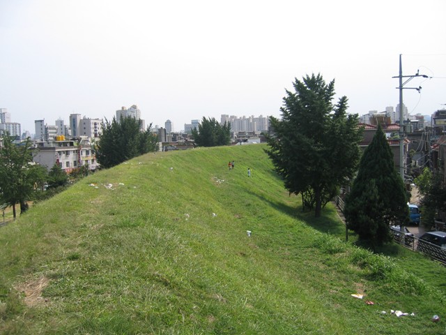
Pungnaptoseong (kor. 풍납토성; hancha: 風納土城) to płaski ziemny wał wzniesiony na brzegu rzeki Han, na terenie dzisiejszej dzielnicy Pungnap-dong w Songpa-gu, w Seulu, w Korei Południowej. Ma obwód 3,5 km. Był niegdyś częścią sąsiedniego miasta Kwangdżu. Posiada wydłużony owalny kształt, rozciągający się na północ i południe, lekko przechylony ku wschodowi. Na podstawie badań prowadzonych w czasie okupacji japońskiej przypuszczano, że Pungnap Toseong było Hanam Wiryeseong, pierwszą stolicą Baekje.
Zachowało się jedynie 2,7 km jego murów. Wraz z murem zachodnim, zniszczonym przez powodzie, obwód sięga około 3,5 km, a powierzchnia niemal 859 508 m². Po wzniesieniu tej centralnej części, mur wewnętrzny, złożony głównie z piaszczystej ziemi, żwiru, gliny i mułu, ukształtowano poprzez usypywanie ziemi pod skosem. Na szczycie ostatniej warstwy ziemnej muru wewnętrznego ułożono trzy warstwy otoczaków, a wewnątrz spiętrzono obrobione kamienie na wysokość 1,5 m, spajając je błotem przygotowanym z naturalnej ziemi, przy czym centralną część usypano w kształcie trapezu o dolnej szerokości 7 m i wysokości 5 m.
Tłumaczenie maszynowe artykułu „P'ungnapt'osŏng” w angielskiej Wikipedii, CC BY-SA 4.0.
Pungnaptoseong zajmuje 5757. miejsce na 8134 w rankingu rozpoznawalności zamków tego atlasu i 18. wśród 58 obiektów w Korei Południowej. W promieniu 25 km stoi 13 innych obiektów atlasu. Najbliższy przewodnik na jednodniowy wypad to Seul, 12 km stąd. Zobacz w statystykach zamków, jak wypada Korea Południowa.
Zobacz na interaktywnej mapie zamków →Najczęstsze pytania
Gdzie znajduje się Pungnaptoseong?
Pungnaptoseong znajduje się w Korei Południowej, na współrzędnych 37.53027°, 127.1162°.
Które miejsce w rankingu zajmuje Pungnaptoseong?
W rankingu rozpoznawalności tego atlasu: 5757. miejsce na 8134, 18. miejsce w Korei Południowej. Rozpoznawalność łączy liczbę wersji językowych Wikipedii z liczbą czytelników.
Pungnaptoseong — który zamek leży najbliżej?
Mongchontoseong, około 1 km stąd.
Inne zamki w Korei Południowej
- Samnyeonsanseong Korea Południowa · V wiek
- Namhae Japanese Castle Korea Południowa
- Doksanseong Korea Południowa
- Dongnaeeupseong Fortress Korea Południowa · XI wiek
Inne obiekty: ruiny
- Cizre Castle Turcja
- Fort Komenda Ghana · XVII wiek
- Shanqal Fort Arabia Saudyjska
- Hama Castle Syria