 Morocco · 11th century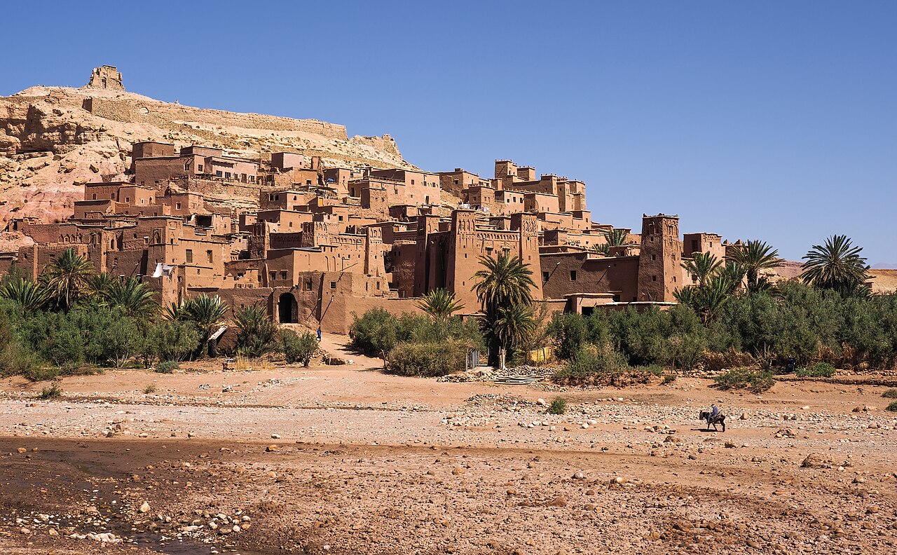
Aït Benhaddou (Berber languages: ⵉⵖⵔⵎ ⵏ ⴰⵢⵜ ⴱⵏ ⵃⴷⴷⵓ, Arabic: آيت بن حدّو) is a historic ighrem or ksar (fortified village) along the former caravan route between the Sahara and Marrakesh in Morocco. It is considered a great example of Moroccan earthen clay architecture and has been a UNESCO World Heritage Site since 1987.
The site of the ksar has been fortified since the 11th century during the Almoravid period. None of the current buildings are believed to date from before the 17th century, but they were likely built with the same construction methods and designs as had been used for centuries before. The site's strategic importance was due to its location in the Ounila Valley along one of the main trans-Saharan trade routes. The Tizi n'Tichka pass, which was reached via this route, was one of the few routes across the Atlas Mountains, crossing between Marrakech and the Dra'a Valley on the edge of the Sahara. Other kasbahs and ksour were located all along this route, such as the nearby Tamdaght to the north.
Today, the ksar itself is only sparsely inhabited by several families. The depopulation over time is a result of the valley's loss of strategic importance in the 20th century. Most local inhabitants now live in modern dwellings in the village on the other side of the river, and make a living off agriculture and especially off the tourist trade. In 2011 a new pedestrian bridge was completed linking the old ksar with the modern village, with the aim of making the ksar more accessible and to potentially encourage inhabitants to move back into its historic houses.
The site was damaged by the September 2023 earthquake that struck southern Morocco. An early assessment of the damage reported cracks and partial collapses, with risk of further collapses.
The ksar is located on the slopes of a hill next to the Ounila River (Asif Ounila). The village's buildings are grouped together within a defensive wall that includes corner towers and a gate. They include dwellings of various size ranging from modest houses to tall structures with towers. Some of the buildings are decorated in their upper parts with geometric motifs. The village also has a number of public or community buildings such as a mosque, a caravanserai, multiple kasbahs (castle-like fortification) and the Marabout of Sidi Ali or Amer.
Text adapted from “Aït Benhaddou” on Wikipedia, CC BY-SA 4.0.
Aït Benhaddou ranks #21 of 9,079 worldwide in the atlas's castle fame ranking, and #1 of the 42 mapped in Morocco. Founded c. 1050, it is older than 89% of the atlas's dated landmarks — one of 436 atlas entries founded in the 11th century. Its Wikipedia articles were opened 60,893 times in the last 60 days, more than 99% of the atlas. 1 more atlas landmarks stand within 25 km. See how Morocco compares in the castle statistics.
View on the interactive castle map →