 Ireland · 12th century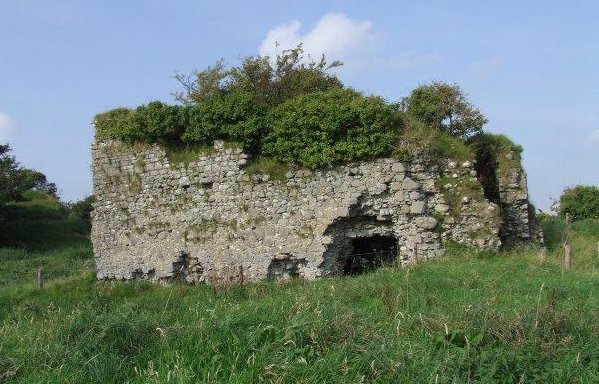
Castlelost Castle (Irish: Caisleán Loiste, meaning 'castle of the losset') is a ruined motte-and-bailey castle located in the townland of Castlelost, just north of Rochfortbridge in County Westmeath, Ireland. The castle dates to the Norman invasion of Ireland, with some sources dating its construction to the late 12th century and associating it with Hugh Tyrrel (died 1199). The castle remained within the Tyrrel family through the 16th century. During the 17th century, the castle and surrounding lands were lost by the Tyrrels during the Irish Rebellion of 1641 and subsequent Cromwellian conquest of Ireland.The only visible features still on the site are the ruined tower house as well as a small nearby motte. The castle, its motte and the remnants of a nearby bailey (courtyard) are listed on the Record of Monuments and Places for County Westmeath.
Text adapted from “Castlelost Castle” on Wikipedia, CC BY-SA 4.0.
Castlelost Castle ranks #8,422 of 9,079 worldwide in the atlas's castle fame ranking, and #177 of the 178 mapped in Ireland. Founded c. 1175, it is older than 79% of the atlas's dated landmarks — one of 756 atlas entries founded in the 12th century. 4 more atlas landmarks stand within 25 km. The nearest day-trip guide is Dublin, 71 km away. See how Ireland compares in the castle statistics.
View on the interactive castle map →