 Ireland · 16th century
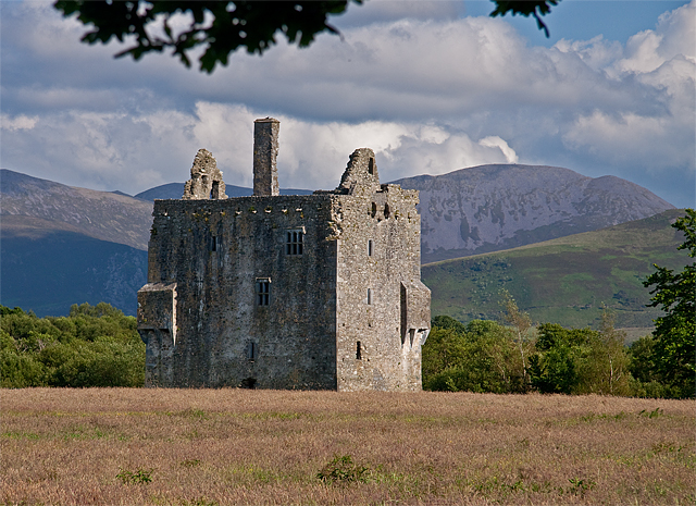
Ballymalis Castle ranks #6,453 of 9,040 worldwide in the atlas's castle fame ranking, and #127 of the 178 mapped in Ireland. Founded c. 1525, it is older than 41% of the atlas's dated landmarks, one of 887 atlas entries founded in the 16th century. 2 more atlas landmarks stand within 25 km. The nearest day-trip guide is Cork, 86 km away. See how Ireland compares in the castle statistics.
Ballymalis Castle is a tower house and National Monument located in County Kerry, Ireland.
Ballymalis Castle is located 4.3 km (2.7 mi) northwest of Beaufort, on the north bank of the River Laune, near its confluence with the River Gaddagh. The Ring of Kerry runs to the north.
This castle was built in the early 16th century by the Ó Muircheartaigh (O'Moriartys). It later passed to the Ó Fearghuis (Ferrises), who renovated it in the late 16th century. In 1677 the manor was confiscated by the British Crown and granted to Sir Francis Brewster, who granted it to the Eager (Eagar) family.
This is a tower house, partially restored. It is rectangular, with four storeys and an attic, with bartizans in the southwest and northeast corners. Also featured are slopstones, a machicolation, chimneys, fireplaces and decorated windows with mullions and transoms. Some of the alure (wall-walk) survives.
Text adapted from “Ballymalis Castle” on Wikipedia, CC BY-SA 4.0.
View on the interactive castle map →