Castle
Bowes Castle
ENG England
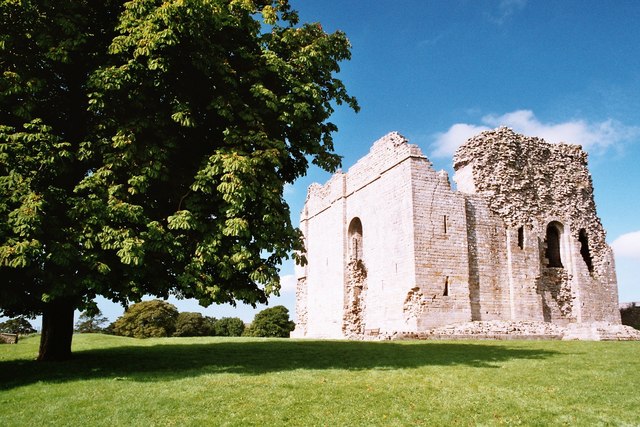
Bowes Castle is a medieval castle in the village of Bowes in County Durham, England. Built within the perimeter of the former Roman fort of Lavatrae, on the Roman road that is now the A66, the early timber castle on the site was replaced by a more substantial stone structure between 1170 and 1174 on the orders of Henry II. A planned village was built alongside the castle. Bowes Castle withstood Scottish attack during the Great Revolt of 1173–74 but was successfully looted by rebels in 1322. The castle went into decline and was largely dismantled after the English Civil War. The ruins are now owned by English Heritage and managed as a tourist attraction. There is free admission during daylight hours.
Text adapted from “Bowes Castle” on Wikipedia, CC BY-SA 4.0.
Bowes Castle ranks #4,440 of 8,134 worldwide in the atlas's castle fame ranking, and #291 of the 333 mapped in England. 7 more atlas landmarks stand within 25 km. The nearest day-trip guide is Newcastle upon Tyne, 57 km away. See how England compares in the castle statistics.
View on the interactive castle map →Frequently asked questions
Where is Bowes Castle?
Bowes Castle stands in England, at 54.5167°, -2.01355°.
How famous is Bowes Castle?
In this atlas's fame ranking: #4,440 of 8,134 worldwide, and #291 in England. Fame here combines how many Wikipedia language editions cover a landmark with how many people read them.
What is the nearest castle to Bowes Castle?
Barnard Castle, about 6 km away.
More castles in England
- Bristol Castle England · 11th century
- Caister Castle England · 15th century
- Calshot Castle England · 16th century
- Tickhill Castle England · 12th century
More castles
- Builth Castle Wales · 13th century
- Caergwrle Castle Wales
- Dundas Castle Scotland · 15th century
- Dunseverick Castle Northern Ireland