Fortress
Cahercommaun
🇮🇪 Ireland · 9th century
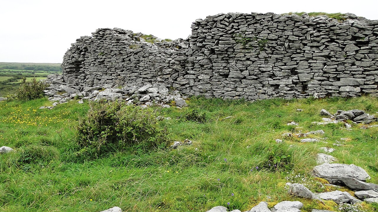
Cahercommaun (Irish: Cathair Chomáin), sometimes Cahercommane is a triple stone ringfort on the south-east edge of the Burren area, in Kilnaboy, near the rural village of Carran, in County Clare, Ireland. It was built in the 9th century.
Cahercommaun sits on the edge of an inland cliff facing north overlooking a wooded valley, with three concentric walls reaching to the cliff edge. The inner wall alone used 16,500 tons of stone. The outer wall measures some 350 ft east-west by 245 ft north-south. The inner wall is about 5 ft thick and 4 ft high and rises 12 to 14 feet above the cliff. The innermost wall, which is the thickest, forms an almost complete circle, but the two outer walls (connected with each other by subsidiary walls, like a fan) only form a semicircle. The innermost wall contains three chambers within the wall.
In a six-week period in 1934 it was excavated by the Third Harvard Archaeological Expedition, led by Hugh O'Neill Hencken, which found that the roughly circular enclosure contained at least twelve stone buildings at various times, some of which had souterrains. The archaeologists concluded that Cahercommaun would have been home to a group of at least 40 people, and among the artefacts discovered were wooden spindles used in weaving. A silver brooch found in one of the souterrains indicates that the site was already in existence by the 9th century AD. The brooch, similar in design to the Tara brooch, is in the National Museum of Ireland in Dublin. In addition to the brooch, a padlock was found.
Some of the conclusions drawn from the work of the Harvard expedition, especially on the period in which the fort was inhabited, have since been revised in light of new information, but the 1934 excavation provided a valuable starting point and basis for further work.
The excavation uncovered one of the most important Iron Age collections found in Ireland. From the collection, a set of sheep shears and a saddle quern are on loan to the Clare Museum from the Irish Antiquities Division of the National Museum of Ireland. Evidence was found of settlement dating back to the 5th century and 6th century, although the fort was built during the 9th century. The saddle quern dates from the Late Neolithic/Early Bronze Age period.
Text adapted from “Cahercommaun” on Wikipedia, CC BY-SA 4.0.
Cahercommaun ranks #4,878 of 8,134 worldwide in the atlas's castle fame ranking, and #81 of the 173 mapped in Ireland. Founded c. 850, it is older than 94% of the atlas's dated landmarks — one of 65 atlas entries founded in the 9th century. 12 more atlas landmarks stand within 25 km. The nearest day-trip guide is Galway, 29 km away. See how Ireland compares in the castle statistics.
View on the interactive castle map →Frequently asked questions
Where is Cahercommaun?
Cahercommaun stands in Ireland, at 53.01472°, -9.07056°.
When was Cahercommaun built?
The atlas dates its founding to c. 850. Earlier structures may have stood on the site; this is the earliest documented founding year.
How famous is Cahercommaun?
In this atlas's fame ranking: #4,878 of 8,134 worldwide, and #81 in Ireland. Fame here combines how many Wikipedia language editions cover a landmark with how many people read them.
What is the nearest castle to Cahercommaun?
Leamaneh Castle, about 6 km away.
More castles in Ireland
- Dún Dúchathair Ireland
- Charleville Castle Ireland · 19th century
- Killeen Castle, Dunsany Ireland · 19th century
- Desmond Castle Ireland · 15th century
More fortresses
- Fort de Barchon Belgium · 19th century
- Fort d'Embourg Belgium · 19th century
- Fort Le Boeuf United States · 18th century
- Fort Laramie United States · 19th century