 Ireland
Dún Dúchathair ranks #4,238 of 9,040 worldwide in the atlas's castle fame ranking, and #68 of the 178 mapped in Ireland. Its Wikipedia articles were opened 973 times in the last 60 days, more than 50% of the atlas. 3 more atlas landmarks stand within 25 km. The nearest day-trip guide is Galway, 46 km away. See how Ireland compares in the castle statistics.
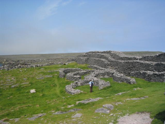
Dún Dúchathair or simply Dúchathair (anglicized Doocaher), meaning "black fort", is a large stone fort on the cliffs at Cill Éinne, (Killeany), Inishmore (one of the Aran Islands) in County Galway, Ireland. Due to erosion, it now sits on a rocky promontory that stretches out into the sea. On its outer side there are large walls, reaching 6 metres high and 5 metres wide. On the inside are the ruins of clocháns (beehive huts) but no water supply. There is also evidence of a cheval de frise protecting the entrance. Its age is unknown.
Text adapted from “Dún Dúchathair” on Wikipedia, CC BY-SA 4.0.
View on the interactive castle map →