Ruin
Dun Aengus
🇮🇪 Ireland · 2nd century BC
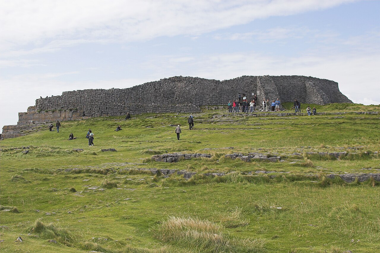
Dún Aonghasa (unofficial anglicised version Dun Aengus) is the best-known of several prehistoric hill forts on the Aran Islands of County Galway, Ireland. It lies on Inis Mór, at the edge of a 100-metre-high (330 ft) cliff.
A popular tourist attraction, Dún Aonghasa is also an important archaeological site.
It is not known exactly when Dún Aonghasa was built, though it is now thought that most of the structures date from the Bronze Age and Iron Age. An early Iron Age bird-head Fibula (brooch) was discovered in a wall of the site in 1839. T. F. O'Rahilly surmised in what is known as O'Rahilly's historical model that it was built in the 2nd century BC by the Builg following the Laginian conquest of Connacht. Excavations at the site indicate that the first construction goes back to 1100 BC, when rubble was piled against large upright stones to form the first enclosure. Signs of human habitation and moulds for casting bronze were found and dated towards the end of the Bronze Age in Europe (around 900 BC). Around 500 BC, the triple wall defences were probably constructed along the fort's western side.
Its name, meaning 'Fort of Aonghas', may refer to the pre-Christian god of the same name described in Irish mythology, or the mythical king, Aonghus mac Úmhór. It has thus traditionally been associated with the Fir Bolg.
The fort consists of a series of four concentric walls of dry stone construction, built on a high cliff some one hundred metres above the sea. At the time of its construction sea levels were considerably lower and a recent RTÉ documentary estimates that originally it was 1000 metres from the sea. Surviving stonework is four metres wide at some points. The original shape was presumably oval or D-shaped but parts of the cliff and fort have since collapsed into the sea. Outside the third ring of walls lies a defensive system of limestone spikes, known as a cheval de frise, planted in upright or slanting outwards positions in fissures of the limestone are still largely well-preserved (cheval de frise can also be found in County Clare at Ballykinvarga).
These ruins also feature a huge rectangular stone slab, the function of which is unknown. Impressively large among prehistoric ruins, the outermost wall of Dún Aonghasa encloses an area of approximately 6 hectares (14 acres).
Text adapted from “Dún Aonghasa” on Wikipedia, CC BY-SA 4.0.
Dun Aengus ranks #983 of 8,134 worldwide in the atlas's castle fame ranking, and #12 of the 173 mapped in Ireland. Founded c. 150 BC, it is older than 99% of the atlas's dated landmarks — one of 12 atlas entries founded in the 2nd century BC. Its Wikipedia articles were opened 7,738 times in the last 60 days, more than 90% of the atlas. 1 more atlas landmarks stand within 25 km. The nearest day-trip guide is Galway, 50 km away. See how Ireland compares in the castle statistics.
View on the interactive castle map →Frequently asked questions
Where is Dun Aengus?
Dun Aengus stands in Ireland, at 53.12591°, -9.76636°.
When was Dun Aengus built?
The atlas dates its founding to c. 150 BC. Earlier structures may have stood on the site; this is the earliest documented founding year.
How famous is Dun Aengus?
In this atlas's fame ranking: #983 of 8,134 worldwide, and #12 in Ireland. Fame here combines how many Wikipedia language editions cover a landmark with how many people read them.
What is the nearest castle to Dun Aengus?
Dún Dúchathair, about 6 km away.
More castles in Ireland
- Carlow Castle Ireland · 13th century
- Manderley Castle Ireland · 19th century
- James Joyce Tower and Museum Ireland · 19th century
- Swords Castle Ireland · 12th century
More ruins
- Montezuma Castle United States · 12th century
- Co Loa Citadel Vietnam · 3rd century BC
- Hardknott Roman Fort England · 2nd century
- Kremenets Castle Ukraine