Fortress
Eski-Kermen
 Ukraine · 5th century
- Founded
- c. 500
- Heritage status
- State Register of Immovable Monuments of Ukraine · federal cultural heritage site in Russia
- Location
- Zalisne
- Coordinates
- 44.61°, 33.74139°
- Open data
- Wikidata Q778912
- Links
- Wikimedia Commons
Description
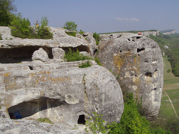
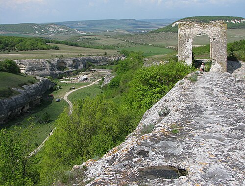
Eski-Kermen or Eski Kermen (Ukrainian: Ескі-Кермен; Russian: Эски-Кермен) was a cave town and fortress in the Crimea in the south of Ukraine. Founded by the Byzantine Empire in the 6th century to defend against the Göktürks, it was conquered by the Khazars in the 7th or 8th century.
The fortress was built on a plateau of about 1 km by 200m. Remains have been found of a basilica. The occupants were probably Alans or Goths. The military importance of the place disappeared after the Khazars had conquered it, but it remained a thriving cave dwelling until at least the 11th century, during the rule of the Pechenegs. It seems to have been deserted in the 14th century, under the rule of the Tatars. Nowadays, most surface structures have disappeared and only some 400 cave rooms remain.
Text adapted from “Eski-Kermen” on Wikipedia, CC BY-SA 4.0.
In the rankings
Eski-Kermen ranks #1,301 of 9,902 worldwide in the atlas's castle fame ranking, and #23 of the 198 mapped in Ukraine. Founded c. 500, it is older than 97% of the atlas's dated landmarks, one of 38 atlas entries founded in the 5th century. Its Wikipedia articles were opened 4,493 times in the last 60 days, more than 87% of the atlas. 22 more atlas landmarks stand within 25 km. The nearest day-trip guide is Sevastopol, 17 km away. See how Ukraine compares in the castle statistics.
Castles nearby
- Kyz-Kule1 km · Ukraine
- Mangup5 km · Ukraine
- Suiren Fortress8 km · Ukraine
- Chorgun Tower9 km · Ukraine
More castles in Ukraine
- Palace of Rozumovskyi (Baturyn)Ukraine · 18th century
- Metropolitan PalaceUkraine · 18th century
- KinburnUkraine · 16th century
- Medzhybizh FortressUkraine · 14th century