Ruin
Suiren Fortress
🇺🇦 Ukraine · 6th century
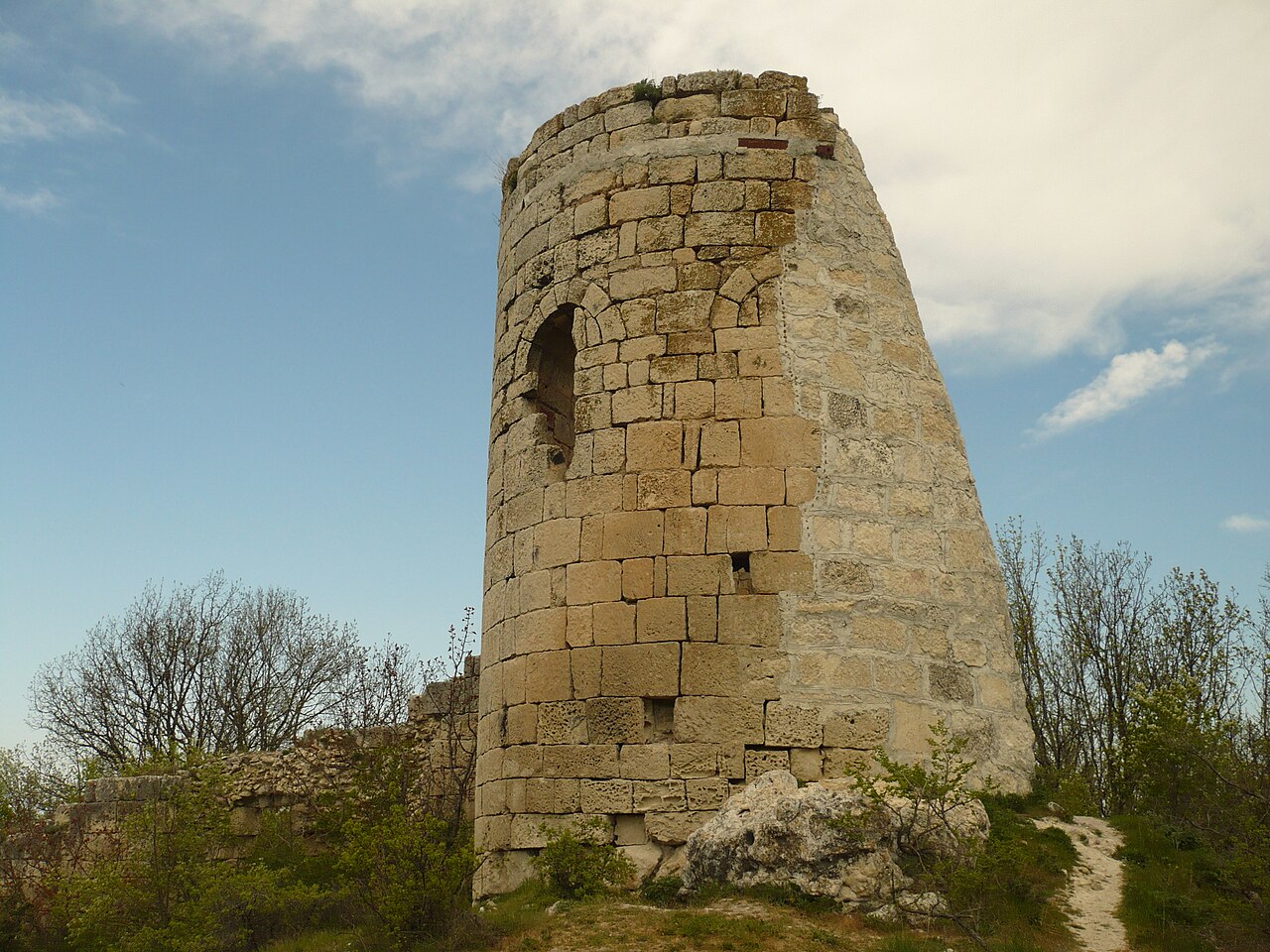
Suiren Fortress (Ukrainian: Сюйреньська фортеця, Russian: Сюйреньская крепость) – a medieval Byzantine fortress in the western part of Crimea in Ukraine, lying near the village of Malosadove and about 15 km from Bakhchysarai.
The name of the fortress means "sharp pike"; it stands on a plateau forming the summit surface of a rocky promontory called Kule-Burun projecting into the valley of the Belbek river, a few hundred metres from the rock monastery of Chilter-Koba, which occupies a neighbouring rocky promontory. The fortress lies at the end of the promontory, covering an area of 1.7 ha, which ends on every side in high rocky precipices. From the rest of the promontory it is separated by a wall built of limestone blocks. According to various researchers it is between 94 and 110 metres long, 2.5 m thick and 4.8 m high. In its central part there is a round defensive tower 8 m in diameter and 10 m high, beside which stood the only entrance gate.
On the upper storey of the tower an Orthodox church was arranged, with walls and a dome richly decorated with frescoes, still visible in the 19th century. About 300 m in front of the wall with the tower described above there is another wall also running across the promontory, 155 metres long, 2.2 m thick and of unknown height (today its remains reach 1.5 m in height). The date of its construction is not known; it is assumed to be the youngest, supplementary element of the fortifications, built in the period of the Principality of Theodoro, in the 14th–15th centuries. The main wall with the tower, as its construction features indicate, undoubtedly arose in Byzantine times, though it is unclear whether at the turn of the 6th/7th century AD or in the mid-9th century (these were two periods of intensified fortification work in southern Crimea).
Machine-translated from “Twierdza Siujreńska” on the Polish Wikipedia, CC BY-SA 4.0.
Suiren Fortress ranks #7,047 of 8,134 worldwide in the atlas's castle fame ranking, and #114 of the 188 mapped in Ukraine. Founded c. 600, it is older than 96% of the atlas's dated landmarks — one of 34 atlas entries founded in the 6th century. 21 more atlas landmarks stand within 25 km. The nearest day-trip guide is Sevastopol, 25 km away. See how Ukraine compares in the castle statistics.
View on the interactive castle map →Frequently asked questions
Where is Suiren Fortress?
Suiren Fortress stands in Ukraine, at 44.6325°, 33.83528°.
When was Suiren Fortress built?
The atlas dates its founding to c. 600. Earlier structures may have stood on the site; this is the earliest documented founding year.
How famous is Suiren Fortress?
In this atlas's fame ranking: #7,047 of 8,134 worldwide, and #114 in Ukraine. Fame here combines how many Wikipedia language editions cover a landmark with how many people read them.
What is the nearest castle to Suiren Fortress?
Mangup, about 5 km away.
More castles in Ukraine
- Pidzamochok Castle Ukraine · 16th century
- Sataniv Castle Ukraine · 15th century
- Yahilnytsia Castle Ukraine · 15th century
- Yaniv Castle Ukraine · 17th century
More ruins
- Zangla Khar India
- Huis ter Kleef Netherlands · 14th century
- Castle Egmond Netherlands · 12th century
- Polanen Castle Netherlands · 13th century