Fortress
Fort du Randouillet
 France · 18th century
- Founded
- 1721
- Heritage status
- monument historique inscrit · classified historical monument
- Location
- Briançon
- Coordinates
- 44.88889°, 6.65361°
- Open data
- Wikidata Q3078372
- Links
- Wikimedia Commons

Description
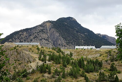
The Fort du Randouillet, is a fortification in the vicinity of Briançon in the Dauphiné region of southeastern France. Briançon was surveyed by Vauban in 1692. His master plan for the defenses of the city would result in one of the most heavily fortified locales in France over the next forty years. Constructed to Vauban's plan between 1724 and 1734, the site was chosen to protect the lower Fort des Têtes from an enemy on the heights. The position was used by the French Army in the defense of Briançon until 1940, when it was part of the Fortified Sector of the Dauphiné.
The fort is composed of an armed citadel or donjon on the highest point, and a caserne on a lower shelf The Fort du Randouillet is linked to the Fort des Têtes by an enclosed, fortified gallery known as "Communication Y." A military aerial tram links the fort to the town, and another continued on to the Fort de l'Infernet.
The Fort du Randouillet, along with the Fort des Têtes and other military works of Briançon, was designated a UNESCO World Heritage Site in 2008, as part of a network of Vauban-related sites in testimony to Vauban's influence on military architecture and engineering.
Text adapted from “Fort du Randouillet” on Wikipedia, CC BY-SA 4.0.
In the rankings
Fort du Randouillet ranks #6,527 of 9,902 worldwide in the atlas's castle fame ranking, and #583 of the 954 mapped in France. Founded 1721, it is older than 20% of the atlas's dated landmarks, one of 757 atlas entries founded in the 18th century. 2 more atlas landmarks stand within 25 km. The nearest day-trip guide is Turin, 83 km away. See how France compares in the castle statistics.
Castles nearby
- Fort des Têtes1 km · France
- Fort Queyras18 km · France
- Fort of Exilles
 32 km · Italy
- Fenestrelle Fort36 km · Italy
More castles in France
- Château de RandanFrance · 13th century
- Château de QuintinFrance · 17th century
- Hardelot CastleFrance · 13th century
- Château de RuthieFrance · 11th century