Fortress
Fort Dunree
🇮🇪 Ireland · 19th century
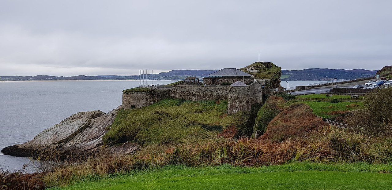
Fort Dunree (Irish: An Dún Riabhach, meaning 'Grey Fort' or Dún Fhraoigh meaning "Fort of Heather") is a coastal defence fortification located on the west side of the Inishowen peninsula, County Donegal, Ireland.
The fort is located on a rocky promontory accessed over a natural fissure. Originally built as part of a series of fortifications defending Lough Swilly during the Napoleonic Wars, located opposite Knockalla Fort on the other side of the lough.
The fort was neglected after the peace of 1815. In 1874 it was armed with seven 24 Pounder guns.
It was remodelled in 1895 to have 2 x 4.7 inch (120 mm) QF guns below, and later 12-pounder (5 kg) QF and 2 x 6 inch (152 mm) guns in an upper land battery. The top of a hill overlooking the site was walled in to form a redoubt. Both 6-inch guns were operational during the First World War.
On 6 December 1921, the Anglo Irish Treaty was concluded. It provided for the establishment of the Irish Free State which happened on 6 December 1922. The Treaty included provisions by which the British would retain sovereignty over three strategically important ports known as the Treaty ports, one of which being described in the Treaty as:
Lough Swilly (d) Harbour defences to remain in charge of British care and maintenance parties.
Accordingly, even after the establishment of the Irish Free State, the Royal Navy continued to maintain its presence at Fort Dunree. Fort Dunree remained under British sovereignty until 3 October 1938 when, pursuant to the Anglo-Irish Trade Agreement of 25 April 1938, the territory was ceded to Ireland. On 4 October 1938, The Times reported on the handover of Lough Swilly at Fort Dunree on 3 October 1938 as follows:
FORTS HANDED OVER TO EIRE - Britain's last forts in Eire, those on the gale-swept Lough Swilly at Dunree and Leenan, were surrendered to the Eire Defence Forces yesterday. The ceremony at Dunree was witnessed by only a dozen spectators. The Union Jack, was hauled down by two Royal Artillery N.C.O.s and the Eire green, white, and orange flag was run up by two N.C.O.s of the Coastal Artillery Defence Force. The ceremony was brought forward from October 26, the date originally fixed under the Anglo-Irish Pact, on account of the international situation. When the British troops left last evening en route for Shoeburyness, their new headquarters, they were given a cordial send off.
Text adapted from “Fort Dunree” on Wikipedia, CC BY-SA 4.0.
Fort Dunree ranks #5,861 of 8,134 worldwide in the atlas's castle fame ranking, and #118 of the 173 mapped in Ireland. Founded 1812, it is older than 12% of the atlas's dated landmarks — one of 607 atlas entries founded in the 19th century. 2 more atlas landmarks stand within 25 km. The nearest day-trip guide is Derry, 26 km away. See how Ireland compares in the castle statistics.
View on the interactive castle map →Frequently asked questions
Where is Fort Dunree?
Fort Dunree stands in Ireland, at 55.19674°, -7.55304°.
When was Fort Dunree built?
The atlas dates its founding to 1812. Earlier structures may have stood on the site; this is the earliest documented founding year.
How famous is Fort Dunree?
In this atlas's fame ranking: #5,861 of 8,134 worldwide, and #118 in Ireland. Fame here combines how many Wikipedia language editions cover a landmark with how many people read them.
What is the nearest castle to Fort Dunree?
Burt Castle, about 20 km away.
More castles in Ireland
- James's Fort Ireland
- Coolhill Castle Ireland
- Dromaneen Castle Ireland · 17th century
- Menlo Castle Ireland · 16th century
More fortresses
- South Channel Fort Australia · 19th century
- Citadel Cyriaksburg Germany · 15th century
- Rustaq Fort Oman
- Al Hayl Castle United Arab Emirates · 19th century