Fortress
Fort Paté
🇫🇷 France · 17th century
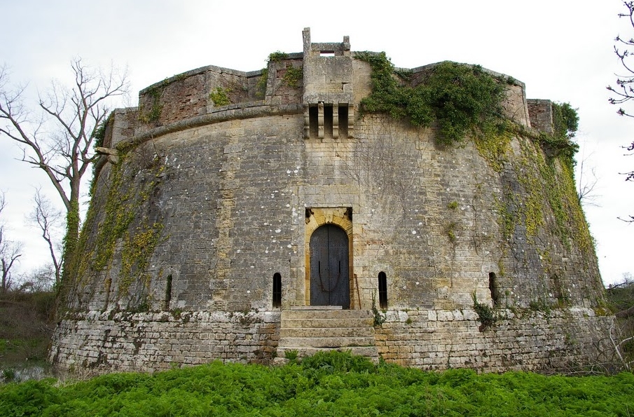
Fort Paté is a round, tower-like Vauban fort on Paté Island in the Gironde estuary, Nouvelle-Aquitaine, France. It, with its twin Fort Médoc on the mainland and the citadel of Blaye, protected Bordeaux from attack by sea. With them, it was listed as a UNESCO World Heritage Site in 2008 as one of the fortifications of Vauban, bearing witness to the importance of Vauban's work in the history and of military architecture in the 17th and 18th centuries.
Text adapted from “Fort Paté” on Wikipedia, CC BY-SA 4.0.
Fort Paté ranks #4,857 of 8,134 worldwide in the atlas's castle fame ranking, and #384 of the 525 mapped in France. Founded 1693, it is older than 23% of the atlas's dated landmarks — one of 626 atlas entries founded in the 17th century. 7 more atlas landmarks stand within 25 km. See how France compares in the castle statistics.
View on the interactive castle map →Frequently asked questions
Where is Fort Paté?
Fort Paté stands in France, at 45.11778°, -0.67861°.
When was Fort Paté built?
The atlas dates its founding to 1693. Earlier structures may have stood on the site; this is the earliest documented founding year.
How famous is Fort Paté?
In this atlas's fame ranking: #4,857 of 8,134 worldwide, and #384 in France. Fame here combines how many Wikipedia language editions cover a landmark with how many people read them.
What is the nearest castle to Fort Paté?
Cidadel of Blaye, about 2 km away.
More castles in France
- Fort Mont-Valérien France · 19th century
- Fort Saint-Nicolas France · 17th century
- Fort Delgrès France · 17th century
- Fort Teremba France · 19th century
More fortresses
- Kaffa genoese fortress Ukraine · 13th century
- Kerch Fortress Ukraine · 19th century
- Kluže Slovenia · 15th century
- Borač Fortress Serbia · 14th century