 Lebanon · 10th century
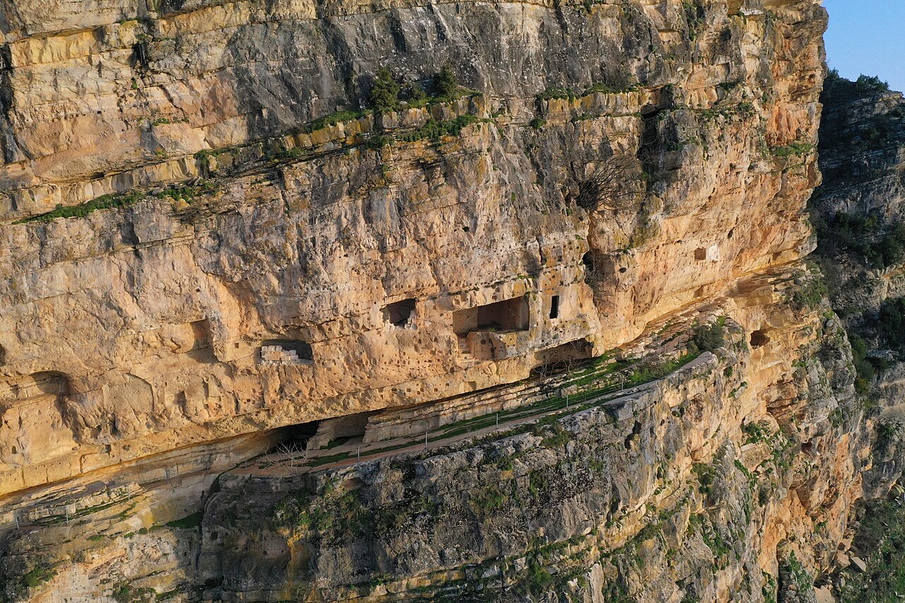
Fortress of Niha ranks #6,025 of 9,040 worldwide in the atlas's castle fame ranking, and #13 of the 17 mapped in Lebanon. Founded 975, it is older than 92% of the atlas's dated landmarks, one of 192 atlas entries founded in the 10th century. 6 more atlas landmarks stand within 25 km. The nearest day-trip guide is Sidon, 22 km away. It is one of the 105 landmarks on the atlas's regional map of the Levant. See how Lebanon compares in the castle statistics.
The Fortress of Niha (also called Cave of Tyron in Frankish sources and Chquif Tayroun in Arabic sources) is an ancient fortress in Lebanon, first mentioned in historical records in 975 AD. It is located in the municipality of Niha Chouf in Lebanon, and is today visited as cultural heritage in the Shouf Cedar Nature Reserve.
Carved into the rock of a cliff overlooking the Bisri and 'Aray valley, the Fortress of Niha overlooks the road between Sidon and the Beqaa Valley. It was first mentioned in 975 AD and then again in 1133. Control over the fortress alternated between the Crusaders and local Muslims until its destruction in 1261. In 1270, the Mamluk leader Baibars ordered it rebuilt. In 1585, the Emir Qorqomaz Maan probably took refuge in it briefly before his death. It is alleged that the Emir Fakhr-al-Din II also found refuge there before he was executed by the Pasha of Damascus in 1635, but it might more probably have been his father Emir Korkomaz, in 1584.
Shaped like a cave over a hundred meters deep, the fortress features chambers and rooms which were excavated in order to shelter soldiers and as depots for domestic work.
Text adapted from “Fortress of Niha” on Wikipedia, CC BY-SA 4.0.
View on the interactive castle map →