 Bosnia and Herzegovina · 13th century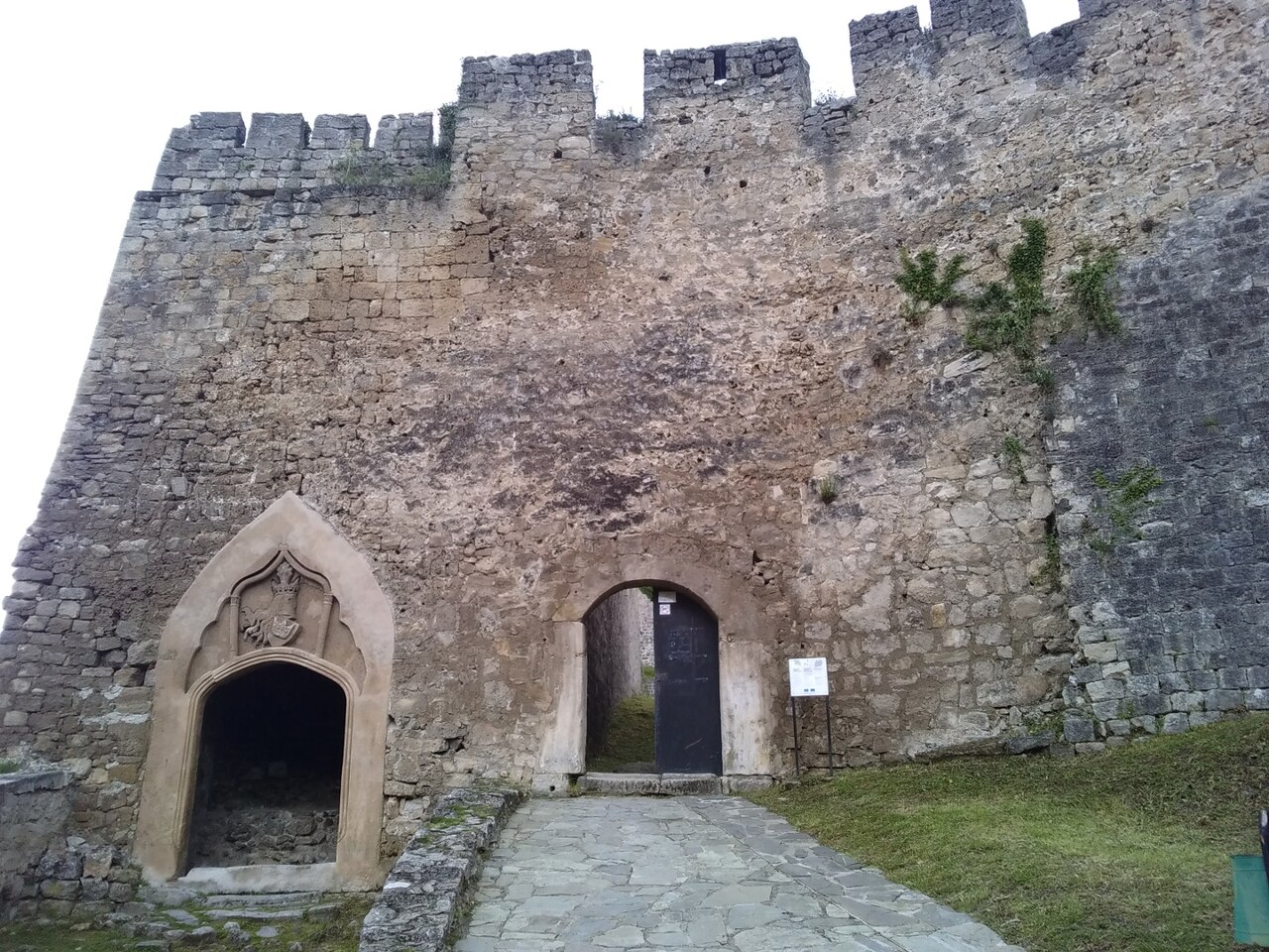
Jajce Citadel, or Jajce Fortress, is a major medieval fortress in Jajce, Bosnia and Herzegovina. It is the focal point as part of the Walled city of Jajce/Jajce Historic Site, and as such protected as National Monument of Bosnia and Herzegovina by the KONS BiH.
Citadel overlooking an old Walled city of Jajce. The Walled city is located at the confluence of the Pliva and Vrbas rivers.
It was founded and started developing in the Middle Ages and acquired its final form during the Ottoman period.
It is the first to be built, on the top of the hill called Hum at 470 m.a.s.l., at the end of the 13th and beginning of the 14th century as the fortress for Bosnian Grand Duke, Hrvoje Vukčić. It was surrounded by a small settlement on the eastern slopes, as it is today. It was repaired, rebuilt and enlarged many times since.
Today, the citadel consists of a main portal, decorated with the coat of arms of the royal Kotromanić dynasty, two large bastions, and inside a gunpowder tower. The walls are traversable with a path along the entire length, connecting Great Southern Bastion with the Great Northern Bastion, constructed on the diagonally opposite corners.
The ramparts and city gates were added, until it encompassed the entire settlement underneath with its large ramparts. The fortress became a citadel and the focal point of the system of fortifications, whose ramparts combined length stretch in a perimeter of about 1,300 metres (4,300 ft) and covers an area of roughly 11,200 square metres (121,000 sq ft).
The walled perimeter encloses Jajce from two sides, with the two main city gates, one at each side, the northern main city-gate the "Banja Luka gatehouse", and the southern main city-gate the "Travnik gatehouse".
The northern perimeter rampart walls stretch from the north-east corner of the fortress, near the Clock Tower, to "Mračna kapija" gate, followed by "Velika tabija" gatehouse and bastion, and from Velika tabija to the "Džikovac tower", from there to "Papaz tower", reaching the northern main city-gate the "Banja Luka gatehouse", and from here wall follows direction toward the river Vrbas, ending at the "Šamić tabije".
Text adapted from “Jajce Citadel” on Wikipedia, CC BY-SA 4.0.
Jajce Citadel ranks #3,486 of 9,079 worldwide in the atlas's castle fame ranking, and #12 of the 40 mapped in Bosnia and Herzegovina. Founded c. 1300, it is older than 61% of the atlas's dated landmarks — one of 1080 atlas entries founded in the 13th century. 2 more atlas landmarks stand within 25 km. The nearest day-trip guide is Banja Luka, 48 km away. See how Bosnia and Herzegovina compares in the castle statistics.
View on the interactive castle map →