Fortress
Kalâa of Ait Abbas
🇩🇿 Algeria · 16th century
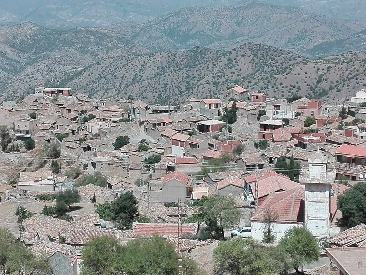
The Kalâa of the Aït Abbas or Kalâa of the Beni Abbes (Arabic: قلعة بني عباس), sometimes spelled Qal'a or Guelaa, was a citadel and the capital of the Kingdom of Ait Abbas, which was founded in the sixteenth century in the Bibans and almost totally destroyed during the revolt of Cheikh Mokrani in 1871.
The Kalâa of Aït Abbas is an important village of Kabylia in Algeria within the tribe of the same name : Aït Abbas. As evidenced by the many ruins, it was an ancient fortress and capital of the local kingdom from the sixteenth to the nineteenth century. It is part of the current Algerian commune of Ighil Ali (wilaya of Béjaïa). The site is located 11 km (6.8 mi) southeast of Ighil Ali, 7 km (4.3 mi) north of Teniet En Nasr, about 30 km (19 mi) northwest of Bordj Bou Arréridj and about 60 km (37 mi) southwest of Béjaïa.
The Kalâa, following the heart-shaped relief, is built on a rocky plateau with an area of 400 ha (990 acres) in the Biban range, at nearly 1,000 metres (3,300 ft) above sea level.
The Kalâa of the Beni Abbès was the cradle and the heart of the powerful independent Berber Kingdom of Ait Abbas.
As the name Kalâa indicates, it is a citadel, protected by the cliffs that almost completely surround it, and also by its ramparts. The only automobile access ends at the entrance to the village. A rampart remains there that protected the ancient city, which, according to the Islamic encyclopedia, had a population of 80,000 in ancient times.
It was built in the same manner as the Beni Hammad Fort: strategic position, difficult access, guarded gates and surrounding wall.
The site of the Kalâa was a Hammadid fort housing a military contingent to control the strategic Iron Gate pass through the Bibans as well as the valley of the Soummam River and a stretch of the triq sultan.
Only ruins remain of the Hammadid fort, at a place named Akhriv Ouziri (ruins of Ziri). The Hammadid parade ground is located in front of the mosque and is now known as Loudha Lhali.
The foundry (1366–1871): French explorers and army officers noted large-caliber artillery pieces found at Kalâa between 1848 and 1865. Charles Féraud (translator officer) wrote in the Revue Africaine of the power of these cannons, given their volume and weight.
Text adapted from “Kalâa of Ait Abbas” on Wikipedia, CC BY-SA 4.0.
Kalâa of Ait Abbas ranks #3,424 of 8,134 worldwide in the atlas's castle fame ranking, and #7 of the 22 mapped in Algeria. Founded c. 1550, it is older than 39% of the atlas's dated landmarks — one of 755 atlas entries founded in the 16th century. Its Wikipedia articles were opened 1,914 times in the last 60 days, more than 66% of the atlas. The nearest day-trip guide is Bordj Bou Arreridj, 31 km away. See how Algeria compares in the castle statistics.
View on the interactive castle map →Frequently asked questions
Where is Kalâa of Ait Abbas?
Kalâa of Ait Abbas stands in Algeria, at 36.29639°, 4.58083°.
When was Kalâa of Ait Abbas built?
The atlas dates its founding to c. 1550. Earlier structures may have stood on the site; this is the earliest documented founding year.
How famous is Kalâa of Ait Abbas?
In this atlas's fame ranking: #3,424 of 8,134 worldwide, and #7 in Algeria. Fame here combines how many Wikipedia language editions cover a landmark with how many people read them.
What is the nearest castle to Kalâa of Ait Abbas?
Petra Mlakou Castle, about 25 km away.
More castles in Algeria
- Palace of the Dey (Algiers) Algeria · 16th century
- Bordj Tamentfoust Algeria · 17th century
- Dar Aziza Algeria · 16th century
- Dar Hassan Pacha Algeria · 18th century
More fortresses
- Fort Saint-André (Villeneuve-lès-Avignon) France · 14th century
- Maglaj Fortress Bosnia and Herzegovina
- Dagnum Albania
- Hutovo Fortress Bosnia and Herzegovina · 16th century