 Algeria · 14th century
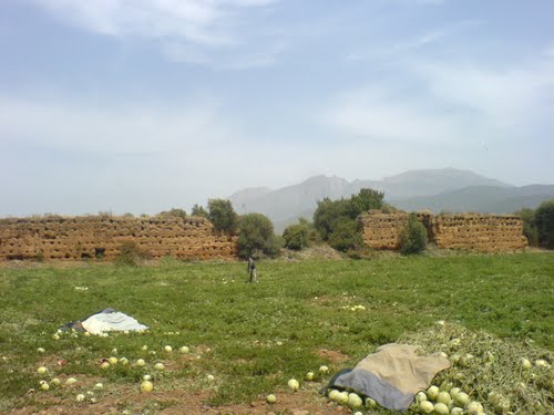
Temzezdekt ranks #8,906 of 9,040 worldwide in the atlas's castle fame ranking, and #24 of the 24 mapped in Algeria. Founded 1327, it is older than 58% of the atlas's dated landmarks, one of 758 atlas entries founded in the 14th century. 2 more atlas landmarks stand within 25 km. The nearest day-trip guide is Bordj Bou Arreridj, 68 km away. See how Algeria compares in the castle statistics.
Temzezdekt (or Lessouar) is the name of a fortress built in the year 1327 under the reign of the Zayyanid sultan Abd-er-Rahman Abu Tachefin, during the siege of Béjaïa, in order to maintain the blockade of the town of Béjaïa, which at the time was under the control of the Hafsids of Tunis. The fortress lies 3 km from the Roman site of Tiklat (or Tubusuctu).
The name Temzezdekt refers to another fortress that stood at Oujda, which the Zayyanids are said to have used before founding their kingdom. The new Temzezdekt was built in 40 days; it held a garrison 3,000 men strong, including cavalry and infantry contingents as well as contingents from the neighbouring tribes.
Machine-translated from “Temzezdekt (Béjaïa)” on the French Wikipedia, CC BY-SA 4.0.
View on the interactive castle map →