 Sri Lanka · 17th century
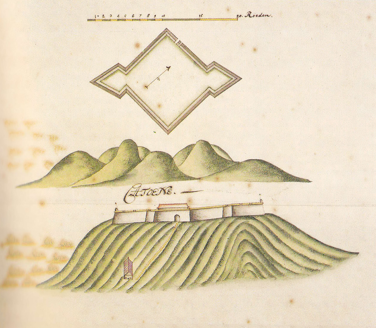
Katuwana Fort ranks #7,578 of 9,040 worldwide in the atlas's castle fame ranking, and #15 of the 15 mapped in Sri Lanka. Founded 1646, it is older than 26% of the atlas's dated landmarks, one of 710 atlas entries founded in the 17th century. See how Sri Lanka compares in the castle statistics.
Katuwana Fort (Sinhala: කටුවන බලකොටුව Katuwana Balakotuwa; Tamil: கட்டுவனைக் கோட்டை, romanized: Kaṭṭuvaṉaik Kōṭṭai; also known as Fort Catuna or Fort Catoene), is an inland fort constructed by the Dutch in 1646.
The Dutch generally built forts along the coastal areas to protect strategic harbours and anchorages from other colonial forces, such as the Portuguese. They did however construct some forts inland, primarily to defend the coastal lowland areas from attacks by the Kingdom of Kandy. Katuwana fort was built approximately 40 km (25 mi) from Matara, in the Kandyan foothills at the northern limits of the Dutch East India Company's territory.
The fort was located on the slope of a hill, with 5 m (16 ft) high ramparts, a single gateway and a 4 m (13 ft) walkway on top. It was diagonal in shape, with two bastions, which each accommodated six cannon, as a result it was often described as a redoubt rather than a fort.
In 1761 during the 'Matara Rebellion' the fort was captured by Kirti Sri Rajasinha's Kandyan forces and partly destroyed. Following the anexure of the Kandy Kingdom by the British in 1815 the fort lost its strategic value and was abandoned.
Text adapted from “Katuwana fort” on Wikipedia, CC BY-SA 4.0.
View on the interactive castle map →