 Peru · 6th century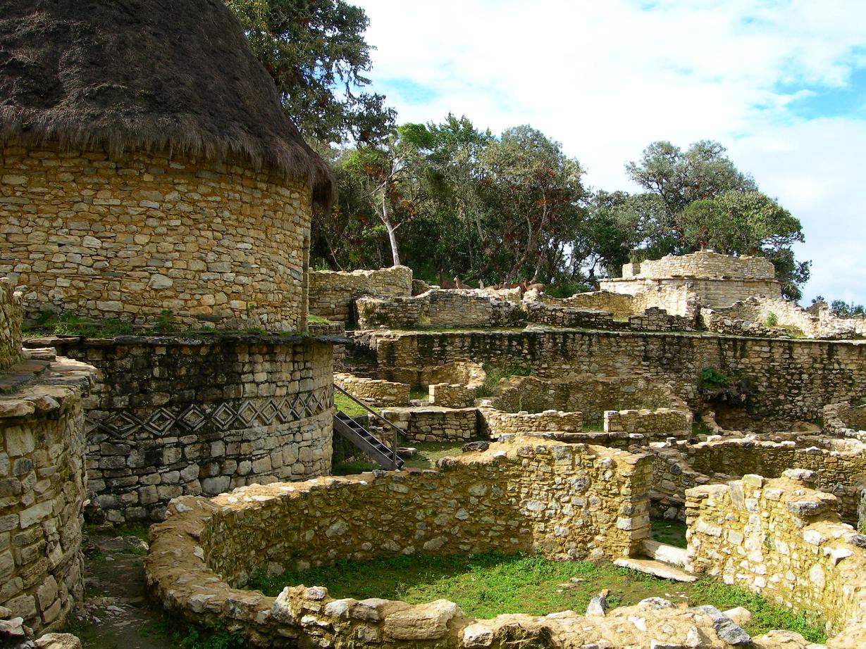
Kuélap or Cuélap is a walled settlement located in the mountains near the towns of María and Tingo, in the southern part of the region of Amazonas, Peru. It was built by the Chachapoyas culture in the 6th century AD on a ridge overlooking the Utcubamba Valley.
Kuélap is located on a limestone ridge on top of a mountain at an elevation of 3000 metres, on the left bank of the Utcubamba River. It belongs to the district of Tingo, Luya Province, Amazonas. The area is covered with cloud forests, with a variety of trees, orchids and epiphytes. The protected zone covers an area of 218.33 ha (2.18 km2) and a buffer zone of 609.67 ha (6.10 km2), both protecting about 12 archaeological sites and the main site of Kuélap.
Kuélap is a now-abandoned walled settlement that covers an area of about six hectares, 584 m from north to south and 110 m at its widest. The walls are 10 to 20 m high with masonry of limestone blocks finely worked (some blocks may weigh 3 tons). The city has three entrances: two on the east, the other on the west. The main entrance is trapezoidal in shape and may have had a corbel arch; it becomes narrower until it allows the passage of one person.
All but five of the 421 structures in the site are circular; those five are quadrilateral. Only the foundations or walls of the structures remain, some of them up to 2 meters high and 50 cm thick. Some walls have friezes, of rhomboid and zigzag shapes, which are protected from the rain by cornices. A few of the structures have been restored.
A 5.5-meter-high structure, now known as El Tintero (Spanish for "inkwell") or Templo Mayor ("main [or major] temple"), in the southwest of the settlement has the shape of an inverted cone. Ceremonial archaeological remains have been found there, and it is hypothesized that the building may have been used as a solar observatory.
In the northwest is a sector known as Pueblo Alto (Spanish for "high town"), entered by two narrow entrances through a wall 11.5 meters high. To the north of Pueblo Alto, a towerlike structure named Torreón ("big tower") rises to 7 meters; it may have been used for defensive purposes, as stone weapons have been found within it.
Many stones at Kuélap bear anthropomorphic, zoomorphic, and geometric designs in relief. Numerous burials have been found both in the walls and inside the circular structures.
Text adapted from “Kuélap” on Wikipedia, CC BY-SA 4.0.
Kuelap ranks #507 of 9,079 worldwide in the atlas's castle fame ranking, and #8 of the 18 mapped in Peru. Founded c. 550, it is older than 96% of the atlas's dated landmarks — one of 39 atlas entries founded in the 6th century. Its Wikipedia articles were opened 7,864 times in the last 60 days, more than 92% of the atlas. See how Peru compares in the castle statistics.
View on the interactive castle map →